
Day 9, May 15, 2008
Trip Stats:
56 km
3:47 in the saddle
14.4 km/hr average
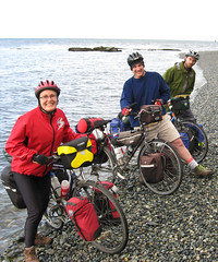
We woke up to coffee, tea, and pancakes – what a huge treat (thank you Rebecca for making the goodies, and to Everest for suggesting pancakes!). We did a slow pack and got on the road sometime around 9:30. At Owen's suggestion we took the rail grade down from Rossland to Trail – we came out at the top of a mondo hill heading down into Trail.
The day was beautiful – clear blue skies and warm weather – even Trail (which sometimes looks a bit down on its luck) looked lovely. We crossed the Columbia and hit the 8% grade up to Montrose. This was a bit of a surprise as today was supposed to be an “easy” day. But, we managed and had fine views of the Columbia River as it left Canada and headed down into the States.
We rolled along through Fruitvale and pulled up at a named “Stop of Interest” -- it turned out to be the Park Siding School. As we were just finishing our lunch on the grass in front of the old log cabin schoolhouse when Jack Bell, the fellow that restored the school, came by to give us the full tour. His Grandmother taught in the little one room place. Jack was also full of stories about the local area – especially the old railways, mining, and logging in the area.
After lunch we continued on down the Beaver Valley, all along the 3B highway. A few kilometres outside of Salmo we joined back up to the main highway 3, and rocketed down to Salmo. We got in to Salmo around 4:00. We pulled into the municiple campground and proceeded to set up for the night. After dinner in camp (bean stew over rice) we stopped in to the Salmo Hotel for a drink. It is quite a colourful establishment – more than a few of the patrons were well into their cups and the talk was all around logging and long distance trucking.
Early to bed for an early morning start - tomorrow we hit the Kootenay Pass.
Day 10, May 16, 2008: The Kootenay Pass Adventure
Trip stats:
87 km
1100 metres climbing
6:19 hours on the bike

This is it, K-Day. We were on the road at 7:30, looking for the Salmo Fire Hall so we could pay for our camping – but we never found it (we'll send the money later, with the suggestion to include better instructions for finding the Fire Hall). From here it is off to the Kootenay Pass.
The first 16 km rolled along very nicely, then we hit the base of the pass. The road got steeper and the views got better. We got a lot of the lower part of the pass done in the relative cool of the morning, but as we got higher the sun seemed to beat down harder than ever. In the the upper reaches of the pass the snow provided extra reflection and Mike got quite a sunburn on his face and legs. Mark was covered up, and I was slopping the sunscreen on regularly.
The push to the summit (1774 metres) was 23 km, and 8 km of those were at 8% grades, the rest were at 6 and 7%. Given that we started at 663 metres at Salmo, this was one of our most physically taxing days yet. However, the views were stellar – there is nothing like the blue of skies of the Kootenays!
We reached the summit in about 4 hours of cycling from the base of the pass. Coming down took a few hours as well, since we had a strong headwind and lots of heat (30 degrees + in Creston). But, we made Creston in good time, pulling in at about 4:00 to Scottie's Campground. At the campground we spent a half hour lying on the grass and looking up through the maple trees at the perfect Kootenay blue sky, then it was out for dinner and a good night's sleep.
ttfn
Mary

2 comments:
Mary, Mark, Mike,
Thank you for the new photos from the road. I especially like the 4 feet up photos on the summits! How well do your bikes work in the snow?
Gemma
Hi Gemma
The bikes are a little bit slow in the snow -- sometimes I have to get Mike to push!
ttfn
Mary
Post a Comment