June 20 - 104km to Wawa
Sitting here in my tent there are approximately 10 million mosquitoes all quietly waiting on my screen door for me to open it and let them in, which I'm not going to. It's kind of unnerving - what if they figure out how to open it? What if they find a hole I don't know about?
Today we breakfasted twice in White River, one at the motel and once in town at Jen's bistro, and then hit the road. It was rollier than yesterday but still flat, and the weather quickly cleared to be sunny and warm all day - first in a while - but more importantly the wind didn't cooperate and the gentle breeze developed into a more forceful southerly breeze which is set to continue for the next few days - unfortunate since we are heading almost due south for the next two days.
We lunched on snack food at the Halfway Motel, which may mark our halfway point of our trip in mileage, coincidentally, but it is named because it is close to halfway from White River to Wawa. In the afternoon we saw two dead moose at the roadside, an adult male and female, both no more than a day or so old, and we have heard from locals that hitting moose is unfortunately quite common at night - one guy we talked to had been in a car that hit a moose just a few days ago: the car was totalled but he was fine.
We got into Wawa about 3 and decided to stay here, though we could have continued another 30km to a camping in the provincial park. A good decision - Wawa is a nice town, despite the three (3) large tacky goose statues that line the road into town. After setting up camp on the shores of the Magpie River we went into town to explore and have dinner. Wawa Lake is a nice setting, and we saw the Big Bike Ride for health research roaming around town - it's a giant (four-wheeled) bike with seats for about 50 people, playing music and riding around town. Very weird. Maybe Mary will post a picture of it with this blog post. We had a fine and cheap dinner at the Columbia Restaurant, which has a Friday night $5 medium pizza special - we plowed through four of them and were very satisfied.
Tomorrow we are planning on staying in Lake Superior Provincial Park at Agawa Bay, which has campsites right on the beach!! Tomorrow should be quite scenic and we expect a few mondo hills to climb, which we've been missing for the last few days.
Mark
June 21, A Superiour Day
101.5
15.9 average
6:23 hrs
The shores of the Magpie River provided us with a quiet night's rest, until we were visited by a four-footed trouble-maker. This happened at about 1:30 pm. The bear started with a thorough inspection of the common garbage area -- twice, just to be sure he didn't miss anything! This caused us all to wake up, but I didn't think anything of it as the garbage area was quite far from our campsite. About 15 minutes later, after I was nicely back to sleep, Mark's blew his alert whistle and I was instantly ... well, alert. A huge shape walked right behind the back of his tent. Of course, it was Mr. Bear on another scouting expedition. We knew there were bears about so we didn't have anything of interest in either of the tents, but put yourself in Marks place: There is a beautiful full moon shining on a nearly cloudless night. The moon is so bright it casts shadows. Suddenly a huge, shaggy, four-footed shape is sillouted across the back of your tent. This is exactly what happened to Mark. So, everyone got up and out of their tents to drive away the bear (that is what the Ontario Parks bear-aware instructions suggest -- yelling, throwing things, making noise). Luckily we didn't have to resort to any of this as the bear was just passing through to other, more lucrative pickings.
The bear incident aside, Wawa campground was very restful, and we got up eager to ride through Lake Superiour Provincial Park. The day certainly didn't disappoint. The park is lovely, with vistas over Lake Superiour, or other much smaller lakes, poking up around every turn. Other than the great riding through rolling terrain highlights of the day included lunch on the wharf in the Adirondack chairs at Red Rock Lake. This is a fine place to stop, and is just below the Park Office about 40 km south of Wawa. Anyone can use the wharf, and it makes a great diving platform for Red Rock Lake. The day was so warm we all cooled off with a swim. This was our best lunch stop yet. We took in other scenic gems, like Old Woman Bay (of course, Mike had to get a picture of me at this stop). We could really feel the moderating influence of Lake Superiour. As we swept down into the bay the temp dropped about 10 degrees.
After Old Woman we visited Katherine Cove, and then on to Agawa Rock and the Ojibiway pictographs right on the Lake Superiour shoreline. Very impressive, and difficult to get to. The  final highlight of the day was camping right on the beach at Agawa Bay. Lake Superiour filled the horizon, a cool breeze and some mosquito coils kept the bugs at bay, and sunset over the water was stunning. A great way to end a fine day.
We also had a number of Charlie sightings reported to us today -- a trucker reported seeing him just a few kilometres back, another motorist reported him to be catching up, -- but even though we waited and went back to see if we could find him, we have not seen him. Hopefully we'll connect in Sault St. Marie tomorrow.
ttfn
Mary
June 22
100km to Haviland Bay on Batchawana Bay.
Tonight I am sleeping in a teepee - how cool is that? The hills are more or less over except for  one big one the locals call the Mile Hill we'll do tomorrow morning. We came around Batchawana Bay - the last of Lake Superior we will see - and found MacCauley's motel and restaurant, run by the very friendly ex-pat Brit Adie, and he cheerfully let us camp, and then said "or you could sleep in the teepees if you like" to which we of course said for sure! He has two full-sized teepees, real ones, all wood poles and canvas covers, set up, unfortunately next to the highway so they were a bit noisy at night, but otherwise very comfortable. Mike and Mary set up their tent, minus the flysheet, in theirs, but I just put down my groundsheet on the dirt and my mattress and slept on that - I bundled up in the sleeping bag and put the bughat on and found the bugs didn't get me at all (teepees are not bugproof).
Also in the evening another cyclist rolled in - his name is Bruce and he's from Cortes Island, which is very cool. He is going to make Mike some espresso in the morning with his portable espresso maker. He is a cool guy - this is the second time he's ridden across the country, first time was to his parents' in Deep River, and he typically does 150km a day.
The final exciting part about today - we passed a plaque at the Chippewa River marking the halfway point of the Trans-Canada Highway! Though we are almost certainly past the halfway point of the trip, this is a cool spot on the highway, and we got some pictures of it.
Mark
June 23 - Through the Soo
118 km to Bruce Mines
Today was cloudy and misty off the lake, though we didn't see the lake again. The last major hill was just south of Haviland Bay at Goulais River, and then it was a gentle downhill all the way to Sault. We stopped at the Velorution bike shop for information and a new chain for me, and then we stopped at the local bakery and continued into town. Downtown Sault is pretty bustling and we went all the way down Queen St to the Canada Locks historic site to eat lunch and check out the locks. There wasn't any traffic through the lock as the Canada side just does recreational traffic now. Then we headed east along the waterfront and continued out of town on the 17 and 17B.
At Echo Bay I was hanging around outside a cafe while Mike and Mary were shopping when another touring cyclist rode in, going in our direction, so that is how we met Mindy who is now cycling with us (or is it us with her?)! Mindy is going from Wisconsin to Philadelphia via the north shore of Lake Huron, and might cycle back too (or part way). She quit her job as a network analyst and is going back to uni in the fall, and is taking the summer to do this trip. She's an awesome travelling companion and it's great to have some more company again!
Her trip blog is here, I hope we get a good mention:
crazyguyonabike.com/doc/greatlakesgreattour
So even though Charlie hasn't caught up with us again - we heard from him tonight, he's in Sault St Marie tonight, he nearly caught us up in Wawa but then got hit with major bugs - we're once again a fourtet cycling along! And Mindy has some odd coincidental similarities to Charlie: she has exactly the same type of bike, same panniers (no trailer though), and same titanium camping pot.
The highway from Sault east appears to be pretty busy and there are usually quite a few big trucks, and little in the way of shoulders, but we are all so used to cycling on roads like this that we have no trouble with it. We got as far as Bruce Mines before deciding to stop for the night - there was a nice municipal campground in town, but the weather had given us a few dumps of rain during the afternoon so the campground was pretty soaked, and with the four of us and cheap motels we got a decent motel room for all of $18 each. Then of course the sun came out and we had a very pleasant evening on the shores of Lake Huron's north channel, cooking dinner in a gazebo on the waterfront.
Mark
June 24
93km to Algoma MillsWe had a cold breakfast in our motel room and were away fairly quickly to the very pleasant lakeshore town of Thessalon for breakfast. Our second lunch was at Iron Bridge, which of course doesn't have the eponymous bridge any more, and a snowmobile bridge in its place. The road is often away from the lake now and we only see glimpses of it, though the riding is very pleasant flattish farmland. Then the road continues along the Mississagi River to Blind River, again on the lake.
Now, I am sure you all think we are supremely tough and studly for cycling across Canada, but today we met some guys who put us all to shame, in that they are WALKING across the country, in 6 months! Followed by an RV for support, these guys are spreading an ant1iviolence message by walking across the country and stoppping at each town to give talks. They walk about 40 kilometres a day and are planning on being in Victoria by the end of October, and we are going to go say hello to them again! Check out their website for more info:
www.walkagainstviolence.com
Mary here -- just a word about our amazing campsite at Algoma Mills -- we are on Lauzon Lake, just off the highway. The campsite has a hot tub, a sauna, and waterfront. We used all of the above, many times! Just down the road is Clarence's Fish where they smoke lake fish -- over 10 tons a year. I got some smoked rainbow for us to sample, and some maple syrup made in the area we just cycled through. All in all an excellent end to a fine day.
Wednesday, June 25, 2008
June 20 - 24: Lake Superiour and beyond
Thursday, June 19, 2008
June 18-19
June 18::Schreiber to Marathon
94 km
16.5 km/hr
Another grey, cold, and overcast day, but once again good winds from the west, and I'll trade west winds for sunshine any day of the week! As well, the cold keeps the bugs down -- although poor Mike got 138 black fly bites on him (we counted), so I'd hate to see this place in a "bad" bug year.
Our worries for this part of the ride have not materialized. The TCH is not busy at all, the trucks and cars are, for the most part courtious, the hills are not as steep and long as expected, and the views, at least on this day, are ever changing.
This is my first time in the boreal forest and I am struck by how similar it seems to an alpine environment. For example, I saw bog laurel and something that looked like a type of anemone at the side of the road; I would see these types of things at higher elevations back on Vancouver Island. A deep lichen is also a prominent feature on the rocks. Perhaps this is what supported the cariboo herds that used to roam here.
Today Mike got his 13th flat -- a piece of wire in the front tire. You should see him doing the dance of disgust as he changes inner tubes, swats at black flies, and curses. His camera stopped working too, so we have to try and get it fixed in Sault St. Marie, or get a new one.
Highlights for the day: Trains manuering at the siding and main tracks around Little Pic River. They wind along the lakeshore up high on the side of a cliff. I can only imagine what life must have been like for the workers that build that railway. Hard work and bugs would have been their lot. It was here that Mike saw a huge black bear. Early in the day we paid a side visit to Aquasabon Falls and then stopped for a 2nd breakfast in Terrace Bay at The Bakery. This is an excellent little place that everyone in town seems to come to for coffee. Everyone we asked said that The Bakery was the best place for breakfast. I got a good vibe from this little town.
We met another cyclist today. Dennis from Korea, by way of St. Catherines. He was heading for Vancouver, and, as a self-supported cyclist, was doing the highest milage of anyone we had encountered so far, an average of 150 km / day. He was 11 days out from St. Catherines.
Today we'll try for White River, we should be at Sault St. Marie by Sunday evening.
ttfn
Mary
I am camping behind a gift shop called May's next to a bunch of RVs and Mike and Mary are staying at the hotel - overall I had a great camp, it rained overnight but was nice in the morning, and we just met up for breakfast at the motel.
Mark
June 19: White River: Bugs and Bears
Today we did 95km to White River from Marathon. We left Marathon in good time after a nice breakfast at the motel on the highway after Mike had fixed TWO flats, both his and Mary's front tires. The ride from Marathon was nice and flat most of the day, we stopped early on at the Tourist Info outside of Marathon while Mike fixed Mary's tire again. Continuing on we passed lots of construction early on, which mitigated the traffic nicely for most of the day. The road was generally OK though the shoulders were spotty, and we left Lake Superior behind, which we won't see again until Wawa. We stopped for a late lunch at Gloria's and Mike got the most enormous breakfast you can imagine, which meant we will probably be having a light supper.
Between Marathon and the turnoff to Manitouwadge we passed a whole bunch of mines, of which the largest, the Williams Gold Mine, is apparently the largest in the world (by some metric).
Shortly after the turnoff to Pic Mobert I passed VERY close to a bear hanging out at the side of the road - he was motionless and so I didn't see him until I had almost drawn level with him, though he has only about 4 metres or so from the road, and so I decided it would be prudent to cycle on past and stop a litle further on. He watched me pass, and then scooted off to the edge of the forest when Mike and Mary pulled up, and Mary got some great pictures of him. He was not very big, probably an adolescent, and seeing as we were close to White River he reminded us all of Winnie the Pooh, who originally came from this area!
Approaching White River the highway goes through the site of the big forest fire in 1999 (at one point every forest fire fighting unit in Canada was attacking this one fire) and the huge swathes of devastated landscpe are a site to see. Coming into White River we learned that the two campsites that we had heard about are now both closed! but the nice lady at the Tourist Info phoned her friend at the White River Motel, and now I am camped behind it in the middle of a big empty field near the edge of the forest, and Mike and Mary are in the motel.
The bugs in this part of the country are AMAZING - Mike is covered with blackfly bites, and I have more than my fair share - though apparently the locals tell us this is not too bad, because of the cool spring. We have learned how to camp in bugs, and the bug hats we all got at MEC in Winnipeg have been a lifesaver. The only problem is eating, for which you a) usually have to be relatively sedentary, b) have to be outside your tent, and c) you have to open up your bug hat for! I have thrown caution to the winds and eaten in my tent once, and walking around while eating also seems to work fairly well. I honestly don't know how the locals can put up with it. The blackflies don't seem to be biting me so much as the usual mosquitoes, but the blackflies have gone after Mike with a vengeance.
We're off now to cook dinner, and I'll go to my tent to sleep in the bugs!
Mark
Wednesday, June 18, 2008
June 16 - 17: The Ride along the North Side of Superiour
June 16, 2008: A day on the Trans Canada Highway -- the first day of the 2nd half of the trip.
Thunder Bay to Nipigon
90 km
5:25 in the saddle
16.4 km/hr average
Here we are at the municipal campground in Nipigon, just a stone's throw from the 49th parallel. The temp is about 5 degrees (forecast to go to 1 tonight, with a positively steaming high of 10 tomorrow). Toques, gloves, mitts, long johns, and fleece are the fashion statement of the day. Its cold, but, its a damp cold, so a little goes a long way. However, summer doesn't actually arrive for another five days, so no need to push the season! It is forecast to get warm some time in the next five days.
Today was all about riding the Trans Canada Highway from Thunder Bay to Nipigon. The road had a great deal of construction on it in the first 30 km of the ride, and there were some incredibly horrible sections (a disgrace for our so-called national highway!), but overall the traffic was much lighter than we expected and the drivers seemed to be fairly courteous. All of us did, however, bail onto the soft shoulder at some time during the day because we felt it was both safe and courteous to do so.
We met two other x-Canada cyclists today. One fellow was from Lyon in France. He started riding from Gaspe and was heading to Vancouver. He reported poor weather for the past few days. The other fellow was from Peterborough. He was heading for the Okanagan, but maybe on going on to Vancouver. He reported headwinds (these winds are great for us). I expect we will start seeing more of our cycling compatriots over the next few weeks.
A big recommendation -- if you are travelling this route, stop at the Birchwood Cafe near Red Rock and have a home-baked cinnamon bun -- very tasty, and the folks that run the place are great to talk to. The Truck Stop at Pass Lake also served a great breakfast. The only animal highlight of the day was a moose swimming across one of the many small lakes that dot the route. Tomorrow we are headed in the direction of Marathon -- views of the Big Lake await.
ttfn
Mary
June 17, 2008: Nipigon to Schreiber -- Big Lake Views.
97 km
16.4 km/hr average
A fine day of riding -- low traffic, good sized shoulders for the most part, and stunning views of Lake Superiour. Now it really is like riding through a Group of Seven painting! The winds continue to favour us by blowing from a westerly direction. There are some hills, but nothing too severe (yet). We felt that the ride yesterday had two hills that would count as big -- the one between Gravel River and Pays Plat, and the one west of Schreiber. The only downside is the weather -- cold, grey, and the odd spit of rain. However, there is a bonus in this too, as long as it stays cold the mosquitoes don't hatch. The highway continues to surprise us with both its lack of traffic and changeable views. We hope this continues.
We met two cyclists yesterday -- Kenneth from Hamilton (going to Inuvik), and Maurizio from Padua, Italy, going to Banff and on to Vancouver. Both had interesting stories to tell and gave us some good tips on what was ahead.
We camped at the Traveler's Rest in Schreiber. Sad to say, the bugs found us. Not mosquitoes, but little black flies. Amazingly annoying creatures! It makes sitting in camp a bit uncomfortable. However, we coped and got into our tents as soon as possible -- Mark even ate dinner in his. Mike and I had to kill about 200 of the little buggers in the tent, but that was soon accomplished and it was off to sleep.
Our only problem now is the cell phone -- we can't receive voice mail, and resolving the problem is going to take a pay phone call to the customer service dept. I don't know when that will happen, so for now I'm leaving the phone turned on so we can get calls.
ttfn
Mary
Monday, June 16, 2008
June 13 - 15: Cruising into Thunder Bay
June 13 Mine Centre (Bliss Campground) to Quetico
135.66 km
7:11 in the saddle
18.9 km/hr
As you can see from the average speed, we made good progress through the lake and sheild country of south western Ontario. We stopped at the old mining town of Atikokan (80 km into our ride -- it was the first place we came to). We detoured off the highway into town and had a fine lunch at the Outdoorsman cafe. We had a chance to chat with some of the locals and got a few good stories about the town, weather, America, gold, bugs, and cancer treatment in Thunderbay and Winnipeg.
14 km after we left Atikokan we saw our first moose. He was browsing in a swamp at the side of the road. We had a good long staring match with one another. Over the course of the next two days we would see one more moose (crossing the road), a dead one, and catch a glimpse of a moose butt as it wandered into the forest.
The weather was in and out rain all day, until we left Atikokan, then a fine blue patch settled in and we had a lovely ride to Quetico Provincial Park where we spent the night. It was here that we got our first taste of Ontario bugs -- the mosquitoes were quite terrible. We were both thankful to have our bug hats! We were also treated to a caterwauling fox in the middle of the night. Mike thought it was a madman with a knife coming to kill us all. We both got up in the night to check the camp and then spent about 1/2 an hour killing mosquitoes in the tent before getting to sleep. However, lest it sound too dire, the sunset at Quetico was spectacular, with loons calling out over the water as soon as the sun went down.
June 14: Quetico to Shabaqua
104.5 km
5 hrs in the saddle
20.9 km/hr
After dealing with the horrible bugs we got a rather late start, but as you can see from the mileage it didn't really make a difference. We had another stunning day in the saddle. Winds from the west, lovely warm and sunny weather, another moose, and the treat of a motel at the end of the day (I wasn't keen on further adventures in bug territory!).
We stopped for a coffee at Kashabowie -- the only stop between Quetico park and Shabaqua. If you ever travel this road, do stop in. The woman running the place (her name is Sandra) is very nice, and has the most beautiful blue eyes. All the local residents stop here too. We had an interesting chat about the mining industry in the area with a retired miner. Lots of exploration going on in the area for gold and platinum.
Although we are not yet north of Lake Superiour, the landscape here makes me feel like I am riding through a Tom Thompson painting. I can certainly see where some of the Group of Seven got their inspiration from. I expect this feeling will increase as we ride around Lake Superiour.
June 15: Shabaqua to outside Thunder Bay
105.5 km
5:46 in the saddle
18.3 km/hr average
Another good wind and fine ride today, with a stop at Kakabeka Falls, a tour of Thunder Bay, a visit to the Terry Fox monument, and a ride on the Lake Superiour shorefront. Today we also rendevoued with Mark and Charlie at Sarah's house east of Thunder Bay.
Due to the recent rains Kakabeka Falls was full of water and you could see the spray and hear the roar from a kilometre away. The falls are just off the road, so it was easy to visit and certainly a must-see. Many of the locals we talked to said they had never seen the falls with more water in it.
We went into Thunder Bay on a quiet (fairly) southern road and ended up in the Fort William part of town. Thunder Bay is made up of two towns - Fort William and Port Arthur. It looked to us like the Fort William part of town was the roughest. It has the mill and the grain elevators. Talking with a fellow from the area we found out that most of the elevators where closed and the mill was running at a very low volume. Clearly Thunder Bay is in an economic down turn.
The Port Arthur part of town to the north is a bit more upscale with some fine residential neighbourhoods and an expansive riverside park. Excellent views of the Sleeping Giant from here. The Giant is a peninsula to the north east of town with huge cliffs that face the city.
We toured up to the Terry Fox Memorial too. The views were outstanding. I can't begin to imagine how mentally and physically difficult it must have been for him to run 42 km each day on a prosthesis from the dark ages -- it is hard enough to get out and do it on a bike! He is certainly an inspiration.
We met up with Mark and Charlie at a lovely cottage in the woods along the shores of Lake Superiour. They had the same fine riding we did, and Mark will give a report on the blog. We will now decide how to proceed next. The next seven days of riding are all along the Trans Canada and the little taste we had today outside of Thunder Bay showed us a busy road with a very small paved shoulder. Starting tomorrow I am sure we will miss the quiet roads of south western Ontario!
ttfn
Mary
ps -- a big hello to Bobby 56 -- the owner of classic cars and a classic lodge (Lakeshore Lodge) along the shores of Lake Superiour, just east of Thunder Bay. We stopped at his place and enjoyed his cars and conversation.
Sunday, June 15, 2008
June 12-15: Mark and Charlie push on to Thunder Bay
Here is a brief little post to recount my adventures with Charlie before I met up with Mike and Mary again. Charlie had to push on to Thunder Bay to arrive early Sunday in order to spend time with an old friend, Sarah, who very kindly hosted all four of us at her house - so many thanks Sarah! - so I carried on with him so that he'd have company through the empty spaces of Northern Ontario. It was a great ride and we had an excellent time together.
So on June 12 (Mike's b-day) Charlie and I left Fort Frances at 9:30 and pushed on to Atikokan, 155km for the day, and arrived at 6:45. During the day we both saw what we believe to be a golden eagle - rare in this area, but almost certainly that was what it was.
It was a very buggy camp and thunderstorms rolled over that night, and then leaving town the next morning (June 13) we were stopped by a guy in a pickup who said that the radio had just said there was a "severe thunderstorm and hail warning" for the area - yikes! So June 13 was cloudy and pressing weather, and we got to Quetico fairly fast and had a late second breakfast while the clouds gathered. Then the rain started, but we only got about 10 minutes of it overall. I saw a mother and baby moose, then a bear just down the road, and we both saw an adult male and then later an adult female moose that day. We did 125km that day and camped at Shebandowan Lake at Burstrom's Resort, and during the day we crossed into the Atlantic watershed - yay! The camp was very buggy again and we had dinner on the dock on the lake because the breeze off the lake kept the bugs off.
June 14 we did a short 60km and came into Kakabeka Falls after sleeping in. We crossed into the new time zone on our way into town! We arrived and set up camp and then spent the afternoon exploring the falls area - Kakabeka is called "Niagara of the North" and the flow over the falls was spectacular as there was something like 8 times the normal flow volume going over it.
June 15, Father's Day, we came into town via Oliver Rd, a back road, got into town at 10 to meet Sarah, and I visited the Terry Fox monument. That marks my "half-way point" across Canada - very cool to visit there. Sarah lives 20km north of town so we cycled out there and hung out, and visited the Silver Harbour Conservation Area which is right down the road from her, and visited with her neighbour Amy. Later in the afternoon we drove back into town for an awesome potluck and so I got to see a little bit of Thunder Bay before we leave tomorrow.
Mike and Mary made great time and arrived in town this afternoon, so it looks like we will be leaving Charlie behind (he is taking a rest day tomorrow) and we will be pressing on to Nipigon tomorrow. Hopefully he will catch us up soon!
Mark
June 9 - 12: Leaving Manitoba and heading into Ontario
June 9 - 80km to Lake of the Woods
Today we started off right with a huge breakfast with Pat and Fran at the cabin on Star Lake and then headed onto the road. It was raining and windy from the east, so not the fastest riding, though the rain let up and the wind let up throughout the day - as opposed to prairie weather, which typically gets worse as the day progresses. Very soon after joining the Trans-Canada Highway at West Hawk Lake we were at the Ontario border - 4 down, 6 to go! The TCH traffic was not too bad and the shoulders were generous in Ontario so we had little trouble with the highway, which was good as we were worried about the sections of road where we had to be on the TCH - this stretch is the only stretch of pavement joining eastern and western Canada. The terrain continued to be classic Canadian Shield - rolling, rocky and treed terrain - all the way to Kenora. Kenora is a very stretched-out town as it goes all along the #17 highway for kilometre after kilometre, so we never knew when the heck the downtown would actually appear.
Being on the TCH, whenever we stopped for services (of which there are many, even in northern Ontario) there are lots of other travellers and we talked to many people throughout the day of our trip, heard about other trips (including two motorcyclists we talked to who were very keen to hear about our trip, they were riding from New York to California via cross-Canada), and had many well-wishers.
The downtown core of Kenora is fairly pleasant. We went to the tourist info just east of town to meet up with Charlie again, but, like us he had been stymied by the headwinds and was slower than expected getting into town (it turned out he had been catching up to us all day, after starting from Falcon Lake in MB, and was just behind us), and we found him when I went back into the downtown to mail home the package I had been carrying around for two days of stuff we didn't need (a few clothes, maps and souvenirs of the western provinces, bungie cords I'd picked up from the road). Charlie, on his way into town, had been flagged down by a guy who offered us a cabin to stay in! So after snacking at Tim Hortons we went 10km east of town and down a fire road to the cabin of Carol and Cory, who left a cabin open for us on their property. Thank you Cory and Carol - their generosity really touched us: they weren't even there (they flagged CHarlie down as they were leaving to go to Winnipeg), they just like to invite cyclists to use the cabin (it had three mattresses) on their property, which is right on the Lake of the Woods and has a fantastic dock. We cooked up a fantastic pasta feast with vegetables on lawn furniture on the deck and then all crammed into the cabin to sleep, very comfortably as it turned out.
Mark
June 10, 2008: Cabin on Lake of the Woods to Caliper Lake on Highway 71 - The Great River Road
118 km
6:44 in the saddle
After a good sleep in the cabin at Cory and Carol's we got up and hit the road through the Canadian shield. Biking attire for the day: two pair of wool socks, thermal long johns, two jackets, toque, and mitts -- this is spring in south west Ontario! Just a tad on the cool side. However, we had a fine day of riding. The rolling hills were a treat, and highway 71 was not too busy at all.
We stopped at Sioux Narrows for lunch -- great view of Lake of the Woods and absolutely covered with trophy fish. Sport fishing is a real force in these communities, it looks like it brings in lots of dollars to the local economy.
Caliper Lake is an Ontario Provincial Park and was a fine place to stay. We camped on the lakeshore and had a beaver swim right in front of our tent. The evening was cold but no rain and a fine sunset.
Animal highlights, other than the beaver, included a tree frog, mother grouse and babies, a sparrow hawk, ravens, bald eagles (big ones!), and turkey vultures.
ttfn Mary
June 11, 2008: The windy road to Fort Francis
Caliper Lake to Fort Francis
90 km
14.2 average speed
The day started well, with the first 60 km going well -- a bit of up and down, shield rocks, trees and water. But, at km 60 (the town of Emo) we turned due east into Fort Francis and the wind was right in our face. It was a difficult 30 km for me. The winds were from the east, sustained at 20 to 30 km/h with gust at 55. A head wind really buffets the bike and you need a strong upper body to control it -- after a few kilometres one can get a bit tired -- and for me, I get slow. Also, the highway became fairly busy from Emo to Fort Francis, so a bit of semi avoidance needs to be practiced too.
In any event, we all reached Fort Francis and checked into the Rainbow Hotel, then it was out for a huge pizza feed at the Pizza Hut. Everyone turned in for a well-deserved night with a roof over our head (lucky as it turned out -- Fort Francis had a huge rainfall overnight).
ttfn
Mary
June 12, 2008: Mike's birthday
Fort Francis to Mine Centre
77 km
18.7 km/hr average
Overcast skies greeted us as we went out for Mike's birthday breakfast in Fort Francis. The four of us decided to break up for a few days Charlie and Mark decided to make a bee-line for Thunder Bay, covering approx 360 km in 3 days to arrive in Thunderbay on Sunday, June 15th in the morning. Mike and I opted for a slower pace -- possibly arriving on Monday, June 16. We will rendezvous at the house of a friend in Thunderbay on Sunday or Monday.
Charlie and Mark set off while Mike and I head into town to shop for groceries. Then we were off across the Rainy Lake causeway where Mike got flat #9. The day was lovely, and we picked up a west wind. With the wind at our backs, and a fine sunny day, the going was easy. Lakes appeared around almost every turn. Mike and I kept a close look out for moose, but didn't see one.
Since we were taking it easy we kept the kilometres low and stopped at Bliss Campground in the small village of Mine Centre. Our camp was on the shores of Bad Vermillion Lake, and we were there early enough in the day to jump in for a swim. it was a very brief dip -- the lake was amazingly cold! But, we did get some sun and water.
Mike's birthday gift was a bug hat (mesh hanging down from a sun hat). We were able to put it to use after dinner as the mosquitos started to get a little much. We hit the tent fairly early, and were just drifting off when a huge thunderstorm hit. Wind, hail, driving rain, lightning bolts and deafening thunder assailed our little tent. The inside of the tent lit up like the mantle in an old Coleman lantern. But, we were snug and dry because of the fine tarping job Mike did. We stayed in the tent and watched all the "sturm und drang" unfold around us. It took about an hour and a half before things calmed down, but we finally got to sleep with the sounds of loons calling on the lake. A fine birthday for Mike -- I'm sure he won't forget it any time soon!
ttfn
Mary
Friday, June 13, 2008
June 13 - in the land of water, trees, and old rocks
June 13 update:
Internet availability is a bit thin on the ground in South West Ontario. We have lots of updating to do, but it will have to wait a few days until we get to Thunderbay (hopefully on Monday, June 15). We are down on Highway 71 and all is going well, although the weather is a bit on and off again rainy -- the good news is, the winds are from the west!!
ttfn
Mary
Saturday, June 7, 2008
June 4, 5, 6: Making our way to Winnipeg
June 4 - 100 km to Cypress River
This morning we were awakened early by the incessant honking of Canada geese and other wildfowl - we had unfortunately camped across the fence from the wildfowl reserve in the park in Souris. Mike and I checked out the view tower over town after breakfast and then we hit the road, after cycling on the Souris suspension bridge (longest in Canada?). Coming out of Souris the road was paralleled, first on the north side and then the south, by endless lines of grain hoppers on the railway line, all seemingly parked. The day was mostly overcast and rain was evident to the northeast most of the day, but a patch of clear sky seemed to follow us most of the day and we did not get a sprinkle - and the winds were thankfully mild and from the north. Perhaps we will miss the worst of this latest weather system, or we'll be in Winnipeg by the time it hits (we have decided to go through Winnipeg to check it out and run some errands, like shop at MEC, and then leave to go through Whiteshell to the north of the trans-canada highway). I saw a good flock of pelicans in a slough, and the others saw a nice muskrat in one of the numerous wetlands we passsed all day. This area has lots of wetlands and we have seen lots of weird birds we cannot identify. We had lunch at Wawanesa, a beautiful little town situated in a horseshoe bend of the Souris river, and I picnicked on the main street and kibbitzed with some locals while the others checked out a cafe.  In the afternoon we went through Glenboro, south of the Spruce Woods provincial park, and on the southern and eastern horizon the Pembina Hills started to be visible. Charlie spotted a coyote quite close to the road, and we got good views of him before he trotted off across the fields. We decided to press on from Glenboro and we are camping at Cypress River, where there is a new picnic area that also seems to be a camp spot associated with the Trans Canada Trail, right next to some lovely marshlands on the Cypress River. We are all camped under the picnic shelter. Tomorrow it is about 150km to Winnipeg, so we will probably be close to the city tomorrow night, and then cycle in to the city on Friday and stay there Friday night.
Mark
Thur June 5, 2008: Headwinds toward Winnipeg Cypress River to Starbuck, 117 km, Highway #2, Manitoba. 7:43 on the bike 15.1 km / hr (the last few hours were around 13 km/hr)
The Cypress River "campsite" was excellent. We're not sure if it was a true campsite or just a picnic spot, but it was lovely. We got a fine prairie sunset, owls at night, purple martins (the birds that look like really big swallows), least bitterns (they have an amazing call -- kind of like a slowly rotating helicopter blade), and, of course, red winged blackbirds. As Mark noted, we were right beside a wetland (marsh and cattails).We later learned that, per hectare, these wetlands are the most productive habitat in the world -- more food produced for more species than even a rainforest.
Our travels today were on a very flat road. We were in the Assiniboine river valley, which was formed as a huge outwash plain in the last continental glaciation about 10,000 years ago. I was very happy to be on the flat, because the head winds were fierce today. We spent a lot of time in a pace line drafting after one another.
We hit a great spot for late breakfast -- I recommend the highway diner at the Mohawk Station in Holland. Highway #2 doesn't have shoulder, so we were keeping to the right quite a bit. However, there were a few times that we had to pull off the pavement because of hay wagons coming a bit close. Hay wagons are the Manitoba equivalent of logging tr ucks loaded with huge cedar logs. These wagons are 18 wheeler flat bed truck with huge roles of hay strapped on. They fly down the road leaving a whirlwind of straw and chaff in their wake.
As the day continued the wind got stronger and stronger until we were doing an average of about 13 km/hr -- and these were HARD kilometres I can tell you. As well, we heard from a passing cyclist that the next day would be difficult, with 20 mm of rain and 50 km/hr eastern winds forecast. We decided to try and get as close to Winnipeg as possible, so we pushed on to the town of Starbuck (not a coffeeshop to be found!). While looking for camping Mark ended up speaking to a fellow who was cutting the grass outside a heritage home: long story short -- Don (the owner of the home) invited us in to spend the night. Don was selling the house so had three huge empty rooms on the second floor. These rooms used to be the very first Credit Union in Manitoba. We got settled in, had dinner and a great chat with Don (and his friendly dog Shania), and went to bed. As a working biologist Don was able to give us some insights into prairie ecosystems. He was also able to tell us how to manage ticks. This is the season for them and all of us have had many of the little buggers climb around on us; most disconcerting I can tell you.
When we woke up the next morning we were so VERY HAPPY to have a roof over our head. The gale and rain had indeed materialized as forecast. We were so thankful to Don for opening his house to us. He really is the epitome of Friendly Manitoba! I resolve to be more like Don in the future.
ttfn
Mary
Fri June 6, 2008: The Winnipeg Push Starbuck to Winnipeg, 42 km.
The rain and wind abated somewhat around 10:30 am so we decided to start off for the 'Peg. This were a bit grim for the first hour, but eased up as we crossed the ring road around Winnipeg and took a back road into town.Charlie was off to stay with friends in a southern section of town. Mark, Mike, and I were headed for Galbraith Bed and Breakfast in the Cresentwood district. So we parted ways, with the intention of joining up again around Nepean.
Our B&B was really deluxe, and our hosts, Lynne and Lindsay, are keen cyclists. Lindsay used to own bike shops, so good storage and a hose-off for the dirty bikes was most welcome. We moved in and then decided to give the walking muscles some exercise as we did a tour of the downtown and the legislature buildings.
Once again, we were happy to have a roof over our heads as it was a very wet afternoon. But, we were warm, dry, and cozy with a cup of tea before bed. All in all, a good visit to the windy city on the plain.
ttfn
Mary
Tuesday, June 3, 2008
June 2 and 3: Two days in Manitoba
June 2: Carlyle to Reston
92.5 km
6:35 in the saddle
A very, very difficult day -- full on east head winds for the entire day. I spent most of the day looking at the wheel in front of me. With four riders one of the most efficient ways to handle a head wind is to draft, one behind the other. In some places the wind was so strong it almost blew us backwards! It seemed like Saskatchewan didn't want to let us go. But, we crossed the border in the later afternoon and made it to a campground in Reston.
I have discovered that cursing out the wind doesn't do any good, so I started to think about Saskatchewan. It was my first experience in the prairie and I was very impressed. Firstly, the province is full of vistas, especially in the west where the country is full of buttes and coulees. And, when the coulees are full of water and bull rushes, the bird life is quite extraordinary.
Mark, Mary, Charlie, Mike
Secondly, the people: Saskatchewan's populace is very friendly -- and not just the "let's be nice to tourists" type of friendly, but a much more genuine type of friendly. We had people pull up to us as we were riding down the road, stop the car, roll down the window and ask us where we were going and where we were from. We had people give us suggestions about where to eat, what to eat, and things that we should really see.
As well, the sense of community in these small southern Saskatchewan towns is something more places should strive for. In Eastend, a town of just over 600 people, the community raised 1.9 million dollars to support the T.Rex Discovery Centre for research and display of dinosaur fossils from the area. In Carlyle a small committee runs a huge park, campground, and pool complex. In Weyburn it seems that almost every local can tell you about the things in the community that you shouldn't miss.
I would like to come back to this part of Canada and spend a bit more time -- but for now, it is on to discover Manitoba.
ttfn
Mary
June 3, 2008: A short ride to Souris
65 kms
Today we did a short day -- only 65 km from Reston to Souris. We rolled in fairly early and caught up on email and blog posts. The wind was quite friendly to us today -- still from the east, but not strong at all. We all needed the rest!
Manitoba is starting to look a little different than Saskatchewan -- a few more trees, and a lot more greenery. Highlight animal for the day -- a muskrat in a slough feeding the Souris River.
So far Manitoba looks very interesting -- more as we go on.
ttfn
Mary
May 31, June 1, A Century in Saskatchewan! (and other stories)

Assiniboia to Weyburn: 166 km
8:04 time on the bike
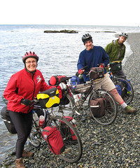
We did it! 100 miles, also known as a "century" from Assiniboia to Weyburn. It was a record day for us all. I did 166 km, my highest day ever, Mark did 168 (his highest)and Mike did 165 (also his highest).
Mark and Mary at 100 miles
We pulled out of a very pleasant campground early in the morning and by noon we had covered 82 km. Winds were good, the cycling was through rolling countryside, and the weather was warm, but not too hot.
We stopped at Ogema for lunch and picnicked at a restored railway station. The rails played an important role in opening up southern Saskatchewan, but the consolidation of rail traffic onto a few main lines, as well as a rise in long distance truck traffic also contributed to the loss of towns. Today we passed by at least two towns, Amulet and Forward that were completely closed up and moved when the railway closed down.
We pulled into the Weyburn campground around 5:30 (an excellent campground by the way -- very friendly camp manager and lots of chance to chat with the locals around the FREE coffee and cookies) and noticed another bike camper. This biker was pulling a BOB trailer and we all said -- "hey, that must be Charlie". Sure enough, about 15 minutes later a fellow walks over to our campsite and we all said "You must be Charlie"! Was he ever surprised. Charlie is a friend of Ian Hogg's. We missed him by one day when we stayed with Ian and Elaine in Fernie. We never thought we would catch up with him, but Wayburn was our impromptu rendezvous.
As we chatted with Charlie two other cross-Canada cyclists pulled in -- Darrick and Si. They left from Vancouver on the same day as us. They were riding recumbent bikes and are running a blog of their trip at www.fresh-entertainment.ca. It was great fun to be in camp with three other x-Canada riders. We had lots of routes to compare and stories to tell.
We ended our century evening with a fine buffet dinner at Mickie's Cafe. So, tired, full, and very pleased with both our great ride and meeting new friends, we pulled ourselves into our sleeping bags and looked forward to a good night's sleep.
ttfn
Mary
June 1 - Travels with Charlie
(with apologies to Steinbeck)
Weyburn to Carlyle - 120km
Today we slept in a bit after our long day yesterday and left Weyburn, bidding adieu to the tricyclists and cruised through downtown Weyburn before turning East again onto highway 13 as usual. We rode with Charlie all day today, it was great to have some extra company and chat about all things cycle touring with him! After about 50km the plains that Weyburn sits in the centre of began to give way to the gentle hill country south of Moose Mountain, and we had lunch at Stoughton at Don's at the highway junction. After lunch we entered OIL COUNTRY - Southeast Saskatchewan is undergoing a huge oil boom and we saw new donkey derricks everywhere and the road was fairly busy with oil tankers and oil worker traffic - something new to us on Highway 13. This boom extends all the way to the Manitoba border so we'll see it again tomorrow.
We had a fairly fast day of riding, though the wind was fickle and mostly from the north, so it didn't help much, and the traffic necessitated us mostly riding on the poor-quality shoulder of the highway instead of in the lane as we often had done west of Weyburn when the traffic was very low. We got into Arcola at about 4ish and decided to press on to Carlyle, another 17km, because the campground has a hottub- but of course the hottub was closed! Mary chatted with one of the volunteers who runs the campground who said that every hotel room in town is full with oil workers, and they can't find workers for the campground -- maybe because everyone wants the high-paying oil jobs. We arrived at the campground, behind the ball diamonds, at the end of a ball tournament so there were lots of people around, but they cleared out fairly quickly in the evening and we had a very quiet night.
Tomorrow Manitoba!
Mark