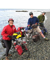
July 28: Cheticamp to the Hideaway Campground and Oyster Market, South Harbour. 97 km 6:45 on the bike
What an heroic day! The ride along the Cabot Trail in Cape Breton Highlands National Park was absolutely thrilling. In my opinion this was one of the highlight rides of the trip so far. The road hugs coastal mountains from outside Cheticamp all the way to Pleasant Bay and the views are superb. There are, however, a few hills to get up!
The first hill is French Mountain. We started this little pull right at sea level and went up 455 twisting metres to the summit. After this haul we were pleased not to descend all the way to sea level, because our next summit, Mckenzie Mountain, was coming right up. This peak is about 350 metres. The ride from here down to Pleasant Bay was a real spinner. We all got up to some fairly high speeds. I think I hit 65 km/hr (I am a coward with high speed, so this was absolutely ripping for me).
This morning we were riding once again with Wally, and on his road bike he could really really pick up speed on the downhills, but with our low touring gears our loaded bikes handled the uphills a bit more easily.
The flora highlight for the day was the hike around the bog trail on the top of McKenzie Mountain. I saw lots of hairy bog orchids and, my favourite, pitcher plants. The pitcher plant is a carnivore and derives a lot of its nutrition from insects that it traps in the "pitcher" and then dissolves and eats. On the fauna front we had one moose and about 15 pilot whales. We saw the whales from our lunch stop on a cliff-top at Pleasant Bay. They were close in to shore so you could see them with the naked eye, but using Mark's binos gave us an even better view.
The morning had been hot and muggy, but in the afternoon, as we started up the third big hill (North Mountain: 450 metres) it started to rain. This was a bit of a blessing because the temp dropped a bit and we had a slightly cooler assent. Lucky for that because the North Mountain ride from Pleasant Bay to the summit has some 12.5 percent grades. This would have been difficult to do in the blazing sun. The spin down from the summit was incredible -- excellent views of the geology in the area. We rode over a huge fault line, which is probably a continuation of the Great Glen fault in Scotland (back when the continents were close together).
We spent the evening at the Hideaway Campground and Oyster Market in South Harbour on Aspey Bay. Wally and Mike were also camped here with their rig. We had a huge communal oyster, snow crab, and lobster dinner where we managed to finish off even more of Wally's wine. The evening was clear and the stars were bright. We ended the evening listening to coyotes howl all around the Bay. Tomorrow would be on to the east side of the Cabot Trail.
ttfn
Mary
July 29: South Harbour to Big Bras d'Or 126 km 16 km/hr
The east side of the Cabot Trail is every bit as lovely as the west. We had another beautiful riding day with winds at our back and huge views at almost every turn. We were able to share another riding day with Wally. This time he took out his mountain bike instead of the road bike and he had a much more enjoyable time in the big hills. And we did have a few big hills to the west of Ingonish. The hill up to the top of Smokey Mountain was not too difficult of a pull, but a good sized hill none the less.
We had stunning views right down on the ocean-side to the north of Ingonish. Then it was on to lunch in town. After we fueled up at lunch it was time to go up Smokey Mountain to the Nova Scotia Picnic Park at the top. The ride was not too hard, and when we rolled into the Picnic Park we discovered four other cyclists taking in the view. All of the cyclists were recently working in Victoria, or students at UVic. I even recognized one of them - Nathan - from school. We were all heading the same direction so we made quite a troop as we raced south down from Smokey Mountain lookout.
Mark had friends in common with several of the riders and one of them, Anna, is friends with Charlie! What a small world. In any event, at around 3:30 they invited us to spend the evening camping with them. Mark took them up on the offer, while Mike and I decided to bee-line for Jan and Alan's place at Big Bras d'Or. Wally was meeting up with Mike at Indian River, and heading on to Baddeck. We parted ways with Mark riding on to join us at Big Bras d'Or the following day. Mark will report on his experiences a bit later.
Mike and I had a simply wonderful late afternoon cycle down to the Englishtown ferry (no charge for bikes!) and an easy ride up Kelly's Mountain. From here it was over the Seal Island bridge (not bike friendly) and into the waiting arms of Alan and Jan on the shores of Bras d'Or. After we parked our bikes the first thing we did was jump in the warm salt water for an evening dip. Then it was off to the dinner table for one of Jan's lobster stews. Sleep was easy coming that night. Here's to friends, old and new!
ttfn
Mary
Wednesday, July 30, 2008
July 28 - 29: Finishing the Cabot Trail and on to Big Bras d'Or
July 26 - 27: Getting started on the Cabot Trail
July 26: Antigonish to West Mabou Harbour
117 km
6:24 on the bike
18.1 km/hr
Big rain in the night and on into the morning. It kept us in our tents until after 7:00 am. Then it eased enough for us to pack up and hit the road by about 9:15 am. Very warm and humid too. I cycled for the first 50 km of the day in my bathing suit. We were joined for our ride today by Wally. We met him yesterday on the road in Pictou. He ended up camping in the same Antigonish campground as we did. He has ridden across from Vancouver. Wally rides about 100 km per day. He is supported by his son Mike, who drives the RV. Since the campgrounds are spaced approx 100 km apart, and since we are all heading up to the Cabot Trail around Cape Breton Island, we decided to share some miles.
2nd breakfast was at the Dragon Fly Cafe outside of Antigonish. A bit early for 2nd, but we decided to take it. Then it was on to the Trans Canada Highway for the ride to the Canso Causeway that connects Cape Breton with the rest of Nova Scotia - we decided to bypass the scenic route, Highway 4, as the TCH would be significantly faster and we had some time to make up. The clouds were still hovering and rain was on the wind, but we didn't see any drops. The TCH here has a fairly good shoulder and what with the long, gentle rolls, we made excellent time to the Causeway. Bikers beware however, the Canso Causeway doesn't have any shoulder and the pavement is quite rough -- but it only lasts for a little while.
Unfortunately, Wally flatted twice and didn't catch up with us until our lunch break on the far side of the Causeway. By this time the clouds were starting to lift and we were beginning to get great views. Also, the road from the Causeway to Mabou (Highway 19) was very fast -- long rolls through little towns like Judique and Port Hood (by the way, if you listen to Canadian Idol, vote for Mitch -- he is from Port Hood and is quite the local celebrity). The countryside was really reminiscent of Scotland. The Scottish settlers arriving here must have thought they were back in the old country -- probably until they got their first taste of winter, apparently it can snow quite a bit here.
We pulled into our campground in West Mabou around 6:00. Wade and Mike kindly gave us a fine pasta dinner -- complete with lots of home-made red wine. It was a great ending to our first day in Cape Breton.
ttfn
Mary
July 27: 89km to Cheticamp
A beautiful day's riding on the edge of Cape Breton, with warm and sunny weather all day. After breakfast we took the highway through Mabou and up into a lovely Scottish-like valley before descending towards Inverness. On the way we stopped at the Glenora Distillery - Canada's only single-malt whiskey distillery for a quick peek (no samples, though). Brunch was in Inverness with deli sandwiches, as the only cafe in town was packed out. On the way into town I explored the last section of the rail trail that goes from Canso Causeway all the way to Inverness - it was a bit rocky and soft but quite nice, we had decided not to take it yesterday because of the poor surface. Too bad it doesn't go further, but the railway it is based on only went to Inverness to serve the coal mines there.
After Inverness the scenery just kept getting better as we continued, sometimes along the coast and sometimes inland, through the coast road to Margaree Harbour and joined up with the Cabot Trail proper up the coast to Cheticamp. Along the way was Joe's Scarecrows, a weird tourist attraction consisting of hundreds of scarecrows at a rest stop... quite odd, from a distance it just looked like a big crowd of people hanging out at the side of the road.
Camping is at Plage St Pierre on C heticamp Island, and we were in camp before 4:00 so we had plenty of time to do laundry and hang out at the very nice beach. The water is superbly warm and the beach a very nice sand and the water is very shallow a long way out.
Tomorrow the REAL hills begin, north of Cheticamp. And this nice weather should hold out for most of the week.
Mark
Friday, July 25, 2008
July 22-25: A Few More Provinces
July 22: St. Louis de Kent to Shediac
102 km
5:43 on the bike
17.8 km/hr average
After an enjoyable evening talking with two fellow campers - Russ and Sue from Oshawa (solar homes in Ontario Cottage Country), it was up at 6:30 am for another day of Acadian Coast riding. This time we had the pleasure of a local guide for our ride -- Jean-Guy. At our parting yesterday Jean-Guy said that he had always wanted to do the ride from St. Louis down along the coast to Shediac, so we said "what about tomorrow?". He said sure, and Jean-Guy arrived at our campsite just after 8:00 am.
We set out together under an overcast sky with a few drops of rain, but with a good (most of the time) tail wind. The wind held and the clouds soon cleared and we had some sun for our ride. We used the coast road -- Highway 505. We went through Richibucto, Cap Lumiere, Bouchtouche, and Grande-Digue. The ride gave us a good look at working fishboats and small docks, estuaries, rivers, and sea side. At Cap Lumiere we had our first view of Prince Edward Island. The roads were in good shape and very quiet. I don't know why these roads are not crawling with cyclists! The views are superb, and the people very friendly. I think that New Brunswick is not promoted enough as a cycling destination province, but I'll certainly recommend it.
Riding in this area was very interesting. This is not a touristed area, so one downside is that there was not a coffee to be had between Richibucto and Bouctouche. But, since we were well off the tourist trail, we had a chance to talk with some residents. For example, the fellow in Richibucto-Village who has a brother, Alphonse, who lives in Ladysmith. And, when you travel with someone from the area, you get to meet his friends too. We stopped in at Saint-Edouard-de-Kent to say hello to Gilles and Rosemarie, brother and sister-in-law to Jean-Guy. As well, one of Jean-Guy's neighbours saw us stopped at the Bouctouche spit and dropped off a huge bowl of strawberries for us to eat. However, we didn't want to ruin our appetites because it was off to Bouctouche village for a lobster roll lunch -- very tasty.
Lest you think it is all about the food, I should mention that the estuaries, rivers, marshes, and dune enviornments on this coast are truely a Canadian gem. From the bayou-like salt marshes of Kouchibouguac National Park, north of Saint Louis, to the 12 km long dune spit outside of Bouctouche, this area is home to all sorts of shore birds, migratory birds, moose, bear, deer, etc. Highlight birds for us today included an osprey with a fish in its talons, heading for a nest.
We said goodbye to Jean-Guy (thank you for the good wine -- much appreciated with dinner) just outside of Shediac and quickly got a campsite just inside of the town. Hopefully we will meet up with him again next week when we are in Cape Breton. Right now it looks like a rainy evening in camp, so tarp and drying from the last rain are important. Tomorrow is a big day, we will be leaving New Brunswick and heading to PEI -- one province closer to our goal.
ttfn
Mary
July 23: Shediac to Cumberland Bay Campground, PEI
91 km
5:30 hours on the bike
Seven down and three to go! Today we left New Brunswick and went over the Confederation Bridge to PEI. Once again New Brunswick proved to have some world-class riding. We started off with some rain and cloud in Shediac, after a surprisingly quiet night (given that we were close to a road and some type of factory). Shediac is famous for its beaches, but no one was sunning themselves in the rain and cool temps of the morning. We stayed on the 133 highway through to Cap Pele, where we left for Highway 950 and the sea-side town of Petit-Cap. This quiet road took us by salt marshes and along the ocean front. It was very interesting to see the mix of working harbours, fish processing operations, and vacation homes all existing side by side.
We stopped for 2nd breakfast at Shemogue on Highway 15, then it was on to the quiet 955 for a seaside ride to the Confederation Bridge and PEI, our eighth province. We got views of the huge bridge well before we arrived at Cape Jourimain (where the bridge touches down on the NB side). It really is quite an engineering marvel, and goes hundreds of feet up into the air above the Northumberland Strait.
We had quite a wait at the New Brunswick Tourist Info for the bike van -- cyclists are not allowed to ride across the bridge, we have to be shuttled. However, while we were waiting I scored a full-sized New Brunswick flag. The one outside the Visitor Info station was a bit tattered, so one of the staff was taking it down for replacement. I asked what she was going to do with the old one and she gave it to me. New Brunswick's flag is very interesting. It has a griffin and a boat on it. None of us are sure what this symbolizes, but guesses of ties with Wales or Scotland, and possibly the John Cabot boat, are the best we can do.
Our first views of PEI featured looking back at the bridge over field and fields of, you guessed it, potatoes. We are now in camp on Cumberland Bay. It is still overcast, but the rain is holding off and we are going to have an early night. The bay is a place of complete quite. All we can hear is me typing and hundreds of birds singing.
Tomorrow we plan on visiting Charlottetown and taking in Province House. PEI looks to be as fine a place to ride as New Brunswick, and it has a bike trail running from one end to the other. We will probably ride on a small part of the trail.
ttfn
Mary
July 24: Cumberland Bay to Northumberland Provincial Park Wood Islands.
102 km
15 km/hr average
Today PEI dispelled us of one main notion -- the island IS NOT flat! At least not on the routes that we took. Keep in mind though that we were "off the beaten track" riding through some of the beautiful green and gold farmland of the south island. Our roller-coaster route took us along some of the red-dirt roads between Crapaud and Emyvale. We followed highway 235 (I think?) into Cornwall (our first big town of the day), and then hopped up on the Trans Canada Highway for a ride into Charlettown.
The TCH leads right to Province House where we had a fine tour of the PEI legislature. A beautiful sandstone building, stuffed with history and presided over by Parks Canada interpretive staff. The island had 27 MLAs and what I think is the smallest legislative chamber in all the country -- about the size of a coffeeshop. We were surprised to learn that PEI has the largest voluntary voter turn out in the democratized world. 90 percent of PEI votes in every provincial election. Also, at 34 Robert Ghiz is the youngest premier in Canada (even younger that the New Brunswick whippersnapper).
We had a quick bite of lunch on the benches outside Province House and then did a tour through downtown Charlettown and headed out east over the Hillsborough bridge to our destination for the evening: the Provincial Park at Northumberland, close to the Wood Islands ferry. On our way over the bridge we stopped to help a motorist in distress (a 911 call).
The afternoon riding was mostly on secondary grid road 26, after following the coast road out of Charlottetown and then the TCH for a bit. This was one of those roads designed by a planner in an office to go straight through the countryside, regardless of topography. It was another roller-coaster. I was less than impressed, especially as we rode by the Trans Canada Trail (a rail-trail -- more exactly, a FLAT rail-trail). However, the peek-a-boo views of classic PEI farmland from the tops of the hills were worth the effort.
Our camp at Northumberland was buggy, but had supurb access to the ocean. I went for a dip -- well, more like a wade.
PEI really is a wonderful place to cycle. Mark and Cathy will be back to do a bit more riding here next month, and I'm sure they will have a great time.
ttfn
Mary
July 25: 100km to Antigonish - 8 down!!! 2 to go!!!
Well, another day, another province. This morning we went down to the ferry terminal and spent some time at the tourist information checking email and asking the TI people everything we could think of to kill time before the 9:30 ferry, which we took to Nova Scotia!! Another province done, and boy was that one fast!!
Major irritation: Nova Scotia has no "Welcome to Nova Scotia" sign!!! Very irritating - I will have to take a picture at North Sydney (assuming there's one there).
We went into Pictou on the side roads and looked at the Hector replica (ship that original Scottish settlers landed on) and met Wally, who is riding from Vancouver (left early June) and is riding with a RV support across the country, but he skips parts, as he rides around 100km a day and then gets picked up and goes ahead to camping. He might ride with us tomorrow towards Mabou!
The views from Pictou were only spoiled by huge mills in the area.
We then went across the causeway and took the back road into New Glasgow, then we got a bit turned around trying to find Highway 4 out of town and ended up on the trans-canada for 10km, which was fast but uninteresting. By this time it was 2 or 3 in the afternoon and we had to get another 50km to Antigonish, which turned into a hot cycle along Highway 4 across the countryside. Nice countryside, very remote - all the towns on the map between New Glasgow and Antigonish are really nothing towns - just a few houses.
On the way into Antigonish I very nearly ran over a stupid chipmunk which refused to move until I nearly creamed him - and I couldn't dodge him because of traffic. Stupid chipmunk.
We are camping in the campground/cottage park called Widden's in downtown Antigonish - hopefully we'll get to near Mabou tomorrow on the coast of Cape Breton.
Mark
Tuesday, July 22, 2008
July 21: Kouchibouguac
122km to Saint Louis de Kent
We started today by cycling 10km west into Miramichi, then over the bridge, through Newcastle, and another 10km east out along the coast road (Water St which merged with 117 10km further up), and after about 25km I was on the other side of the river looking across to the campsite where we had stayed - kind of pointless, but there not being any boats to take us across the river that is what we had to do. Today we went around the coastal road through Bay St Anne and Escuminac, with lovely views of Miramichi Bay around to Pointe Sapin on the Gulf coast and finally through Kouchibouguac (Koosh-uh-buh-wack) National Park to Saint Louis.
The landscape around the peninsula was not what we expected - very flat, huge bogs (we past a peat-moss factory) with weird carnivorous plants (the bucket-type ones that trap flies) and scrubby alpine forest.
In Kouchiblahblahblah we met Jean-Guy from Saint Louis, who is a teacher (almost retired) who cycles and hikes every day and is super fit - he told us all about the park and guided us on the bike path through the park to the camping right outside Saint Louis. What a great guy! We hope to see him again tomorrow as he says he's interested in cycling down through Bouchtouche with us.
In the park we had noticed a few agressively anti-government signs on a house there, and Jean-Guy told us how when the park was created in 1971 there was a bunch of houses expropriated and one guy stayed and is still there, fighting in the courts to not have his land taken away (I guess he didn't think the compensation was enough?).
Tomorrow we'll be heading for somewhere near Shediac.
Mark
Monday, July 21, 2008
July 18-20: Some New Brunswick
July 18: Val-Brillant Quebec to Campbelltown, NB - Six down! Four to go!!
121 km
17.4 km/hr avg
6:58 on the bike
What a perfect morning! The sunrise streamed across the lake, arrowing in on the front door of our tent, lighting up the whole valley. Val-Brillant indeed! (although the town was named after a priest). This campground was one of the best we have been in -- quiet, good aspect, good facilities, and nice people running the place.
We had another great day on the road. Travelling on highway 132, and La Route Verte we travelled by some lovely little towns -- Amqui, with two covered bridges, Causapcal, on the banks of the Matapedia, and Matapedia itself, just at the border with New Brunswick.
The Matapedia river was our companion for most of the day. It is an Atlantic salmon river, and huge fish are caught by fishers quite regularly. We met a guide-outfitter (he used to be the head coach of the Rimouski Oceanic -- when they won the Memorial Cup in 2000). The water in the river was clear, with shady banks and a good gravel bottom. Seems perfect for salmon.
And finally later in the day we passed through Matapedia itself and over the bridge into New Brunswick. I really didn't want to say au revoir to Quebec. The Chemin du Roy, the South Shore, and the Gaspe were a wonderful introduction to Quebec history and culture -- I certainly want to come back soon.
In New Brunswick we were on the 134 highway into Campbelltown. What a rollercoaster-- but, as I often say, "pay your dues, get the views", and we got some great views of the Chauleur Bay from the top of Morrisey Rock lookout.
After some too-ing and fro-ing at the Campbelltown tourist info we ended up backtracking to Sugarloaf Provincial Park for some camping. The site ended up being very nice, and we met another touring cyclist - Steve from Olds Alberta. He was going from Moncton to Ottawa. After dinner, a bit of conversation, and a good shower (very important as far as I am concerned), we went hit the tents for a good night's sleep.
ttfn Mary .....
July 19: 99km to Petit-Rocher
Our first full day in a maritime province. How exciting to see non-Catholic churches and hear French and English intermingled.
After cycling back down into Campbellton we visited the tourist info to do some internet and contact Ken in Fredericton - and indeed he came up to camp with us tonight. Then we took the coastal road, route 134, along the coast of Chaleur Bay all day. The road has some very nice stretches and is mostly pretty interesting and very low traffic, and we passed through some pretty industrial areas with a few big mills and plants - Campbellton is fairly industrial and has a big mill, Dalhousie has two big mills, and we passed a huge lumber mill and a big coal power plant at Belledune. Our second breakfast in Dalhousie was in the one breakfast joint in town, and we had some interesting discussions with locals about our trip. Finally towards Bathurst the road gets into more cottage-like areas and there appears lots of camping. We are in Camping Marie-Helene (how could Mary-Ellen resist that?) and we finally caught up with Ken Kent - after doing some flooring in the morning he got on his motorcycle and road up and met us here after dinner.
And what a dinner! Our gracious host Pierre told us all about himself and the camping, set us up in a choice location right on the beach, got us a table, umbrella and chairs, and then came out with a big mackerel pie and a bottle of wine for us to enjoy! What a fantastic fellow. He even has a trampoline that we've been jumping on. Pierre has just taken Mary and Ken into town in his van to do some shopping (read: liquor store) and goodness knows what else he'll provide for us - we're hoping for a big breakfast or something tomorrow :)
Today we also learned that the motto of New Brunswick is "hope restored", in German. And nobody knows it because it isn't on the license plates.
And tonight I swam in the Atlantic Ocean for the first time! Isn't that exciting!
Mark
July 20: Petit-Rocher to Lower Newcastle, Miramichi
92 km
6:30 on the bike
Another morning in paradise -- I could get VERY used to this. We woke up as the sun slid through the morning mist, across the Baie des Chaleurs, and into our tent. Pierre, the owner of the Marie Helene (Mary Ellen en francais) campground thoughtfully brought fresh coffee to our tent-side at 7:30 am. Even though I don't normally drink coffee I had some -- it hit the spot. Mike, Ken, and I had been up very late the night before. Mark, surely the more reasonable of the group, went to bed at a reasonable hour. But, I do plead the lure of L'Acadie. We spent the evening at a big beach bonfire with about 20 Acadian folks who either live close to Petit-Rocher, or stay regularly at the campground. The drink was flowing pretty freely, but the amazing thing was the singing. Two guitars and many voices did all sorts of songs -- most in French. But, the best songs of all were the local Acadian folk songs, especially the song about Petit-Rocheur itself. Mike and I finally decided to call it a night around midnight, but Ken stayed on.
It was wonderful to have Ken drive up from Fredericton on his motorcycle and camp with us. We caught up on all the Kent family doings. It was too bad that Elizabeth and Hailey were not able to join us. Ken joined up for 2nd breakfast in Bathurst later that day.
Our ride for the day took us down Highway 134 through Beresford to Bathurst. Then, staying on the 134 we turned inland, cutting off the Acadian Peninsula. In retrospect I don't know if that was the best route as there were NO VIEWS! After a few weeks in Quebec and the last few days in New Brunswick, I am spoiled. I want to see ocean, beaches, rivers, cliffs, panoramas, that sort of thing. However, the route, with the exception of the small part we did on Highway 8, was very quiet and the road was a good one.
We ended the day's riding well with a pretty back-road route through Russellville and then on to Lower Newcastle and our camping for the evening. We were nicely in camp, with dinner just finished when a huge thunderstorm came rolling in. All three of us were caught out, and even though it was only a hundred metres to shelter, we all got soaked. So did our camp. Luckily, Mike and Mark decided to put up the tarp, so at least we had a relatively dry space to huddle under as the rain came down. The heavy rain lasted at least 30 minutes, after which it was just regular rain. Mark's tent has a leak, but he mopped up with his trusty towel, while Mike was out digging drainage ditches to stop the water from pooling beside our tent as it sheeted off the tarp. Although it was exciting, everything calmed down by about 9:30 and we all got into our sleeping bags and settled down for the night.
ttfn
Mary
Friday, July 18, 2008
July 14 - 17: Last days on the Fleuve St. Lawrence
July 14 - 100 km to St-Jean-Port-Joli
Today was a fantastic day of riding along the south shore of the St. Lawrence - with a nice flat road, clearing and getting sunny weather, and a (at times stiff) tailwind. And, I should add, that today was officially my arrival on the shore of the Atlantic Ocean, a pretty great milestone. I say this because after Ile d'Orleans the St Lawrence becomes tidal and brackish, so coming over the main hill after Beaumont (under the power lines) you get the first great view of the river opening out between Ile d'Orleans and the south shore, which is the first view of the "ocean", and then today we were cycling along the water and at our campsite, which is right on the water, I went down to the water and splashed in the ocean. Yay!
Today was also fantastic for meeting other touring cyclists : first and foremost, we met Don from Cranbrook who is cycling from Ottawa to Moncton. He is taking a great leisurely tour and we have been riding together all day and now we're camping together. Then we chatted with Pierre, riding from Montreal to who-knows-where, who passed us twice more during the day, who was riding with very little gear and staying at hotels. Then two pairs of tourists from Quebec who were about five minutes apart, Gilles and Rene and another couple we didn't get the names of, and finally I chatted with two great young guys named John and Luke, who are from Ottawa and riding from Vancouver to PEI. They left May 22 and took the Trans-Canada most of the way, and are now "slowing down a bit!" in their words.
Most of these towns along Highway 132 on the south shore are fantastic little towns with the usual 2-or-300-year-old church with fine little houses lining the road, and the views for much of the day of the river, hills inland, and mountains across the river are quite lovely. After our big breakfast at the B+B we only stopped for a light lunch at Montmagny, at a park next to the lovely waterfall there, and a few light snack stops, and otherwise just stopping at interesting spots (and to talk with the cyclists we see). We also stopped so Mike could check out the motorcycle museum in Saint-Jean-Port-Joli. The town is stuffed with artisans and shops of various stuff, and is very pretty (as the name implies).
Tomorrow we'll hopefully get past Riviere-du-Loup (River of the WOLF!!).
Mark
July 15: St-Jean-Port-Joli to Rivere du Loup (Mike and Mary), L'Isle Verte (Mark) 127 km 7 hrs on the bike
What a perfect morning -- fresh air, low humidity, a booming west wind to help us go east, sunny, but not hot, and a bike route along the shores of the St. Lawrence. It is hard to get better than this! It is great to be back alongside the sea -- it feels like home. Last night, as I was up for my nightly p&p (pee and perambulation) I was surprised to get my first smell of saltwater tang and see my first tide in over 69 days. Our campsite was right on the St. Lawrence shore, and the water was lapping up against the rocks just below the tent --reminded me of Sombrio Beach!
Today we kept as much as possible to the Route Verte, but it did disappear in a few place. After a fine 2nd breakfast we rode along an off-road path through the estuary of the Ouelle river. Fireweed, loosestrife, primrose, yellow buckwheat, and red elderberry bushes bent over with berries lined the route. Bird song of course -- our old friends the red-winged blackbird, and in the distance, in the forest, the white throated sparrow. Limestone outcroppings (at least I think that is what they were) made the afternoon landscape interesting and different.
We easily rode through the big town on our route - Riviere du Loup. But, on the way out, trouble struck. We were all travelling though the town of Cacouna, on a very bumpy section of the 132 highway. We were going downhill at a high speed. Mike and I were behind when Mike hit a pothole. At this point, his rear rack (it holds most of his gear) sheared off right at its attachment to the rear axle of the bike and lodged in the spokes of the rear wheel. Luckily none of the spokes broke -- but, Mike had to have a new rear rack. I took most of the heavy items from his bike and he jury-rigged the frame so we could limp back to Riviere du Loup.
Mike and I got a place at the Riviere du Loup muni campsite and set up. Then it was off to the far end of Riviere du Loup to the Canadian Tire to see if they had a rack. No joy there. We will have to wait until tomorrow morning at 10:00 to see what the bike store has.
Meanwhile .... Mark is wondering what the hell happened to us! Luckily we had the cell phone, Cathy in Victoria, and a very helpful campground in L'Isle Verte. The campground let Mark call Cathy long distance for free (I had called Cathy earlier and apprised her of the situation, so she could tell Mark). Also, Don (who was travelling with us on this day) was able to call and I let him know the situation. With everyone all squared away, Mike and I settled in for a good night's sleep.
Mary
Mark here: meanwhile Don and I stood around at the side of the highway for about an hour chatting until we figured something must be up, so, we being closer to the next town than Riviere du Loup, Don cycled on to L'Isle Verte to find camping and a phone while I sat by the side of the road. I was dolled up in rain gear so I put on my bug hat and sat while the mosquitoes vainly tried to find a way in to bite me - unsuccessfully, for once. Don came back in about 30 minutes, he found the camping and phoned Mary and came back and got me, and we, much relieved to find out M+M were OK, went on to L'Isle Verte to camp.
And boy did we get rained on at the camp! Holy schlamoley we got the hugest 10-minute blast of rain there ever was - Don was totally soaked, thank goodness we got our tents up in time, all it did was water down our dinner.
Mark
July 16: Riviere du Loup (Mike and Mary), L'Isle Verte (Mark) to Parc du Bic 72 km (Mark) 95 km (Mike and Mary)
I spent a nice morning eating breakfast on the quay in L'Isle Verte and exploring the town while awaiting Mike and Mary to show up - they successfully found a bike rack in Riviere du Loup and installed it, and then met me at L'Isle Verte at noon. Don meanwhile had taken off after breakfast so I bid him adieu - if you're reading this Don, hope you had a great trip!! I met another touring cyclist, Jeff, who I had exchanged greetings with in the camping at L'Isle Verte the night before - he was the only other camper along with Don and I. Jeff, who was from Montreal, was cycling from Riviere du Loup, up the north shore to Tadoussac, and then across the ferry and down again.
Then we set off for another gorgeous day cycling along the St Lawrence - despite a small spatter of rain it was mostly excellent, with the road away from the coast at times in a lovely valley near the river. The scenery was lumpy limestone hills - Cathy they were much like the mogotes near Vinales in Cuba - and pleasant farms, and we passed lots of walkers on the road. We learned later in Trois Pistoles that this is a pilgrimage route that lots of people walk, from somewhere I can't remember to somewhere else I can't remember.
We camped at the "National" Park of Bic (Quebec calls all its provincial parks "national") and I had time to do a nice hike around a couple of the bays, where I saw some seals.
Mark
July 17 - 117km to Val-Brillant on Lac Matapedia
This morning I met Byron from Magog, who is cycling from Halifax to Montreal, where he will work for a month, and then go on to Vancouver - go Byron! Byron was carrying the most gear of anyone I've seen so far - he must have 150 pounds of stuff.
And then, later in the day, we met Felix on the road, who is doing a very cool bike tour: from Montreal up the south shore, then a ferry to the north shore, and then he will ride north to the very end of the road, near Labrador - very studly. We met him fixing a flat, and then later on we saw him fixing another flat with help from our friend Don, who we'd last seen yesterday morning. But we left Don behind again as he wasn't going as far as us today.
As for the riding, another gorgeous day, our last in fact, along the St Lawrence - Rimouski has an excellent bike path along the downtown waterfront, and then north of town the bike route follows a lovely coastal road, all old mills and old farms, along the water past Pointe-au-Pere where the pilots for the St Lawrence were stationed, and where the tallest lighthouse in Eastern Canada is (pay admission, didn't go in). Finally we left the river (now ocean) behind at Saint Flavie and climbed up to Mont Joli into the Gaspesie region proper- a few more climbs, a few more small towns, and we were cruising down towards the Matapedia Valley region, which we'll follow all day tomorrow to THE NEXT PROVINCE!!! namely New Brunswick.
We are camping at Val-Brillant, right between the lake and the lovely twin-spired gothic church, and the camping lady is very nice and practised her English a lot on us. Also they have an unsecured wireless network so we'll hopefully upload all this in the morning. Great sunset too!
Later
Mark
Monday, July 14, 2008
July 10 - 13: Chemin du Roy -- Travels on the King`s Highway
July 10: Montreal (Verdun) to Lanoraie (Chemin du Roy)
78.7 km
15.7 km/hr average
5 hrs on the bike
(Sorry - no images, I am on a machine that won`t allow me to spell check or add pics!).
Another great night to be inside! Around 9:30 pm the skies opened and it poured. Thank you again Corrine and Jean-Francois. Morning found us all well rested, and after some strong coffee and a good breakfast (thank you Corrine), we rode along the Lachine Canal bike route into downtown Montreal for some sightseeing before heading east.
We rode up to Place des Armes and saw the basilica. Mark had never been before so he paid the 5.00 and went inside for a view. He reported it as being very ornate. The design was inspired by Sainte Chapelle in Paris and, having recently been in Sainte Chapelle Mark said he could see the similarities. It is certainly one of Canada's finest cathedrals.
From the basilica we went through the old town -- cobblestones and all! We had a quick look at Beausecours and then headed down to the bike route. We got on La Route Verte #5 and travelled north east up the Island of Montreal until we crossed the river on a small bridge south of Charlemange. The Route was quite circuitous here and we travelled a few kilometres out of our way through back streets, along railway and power corridors, through parks, to the small town of L'Assomption. Here we saw the first of the area's Roman Catholic church spires. They are sheathed in some type of silvery metal that gleams on even the greyest day. They rise above the towns and can be seen for miles around from the flat valley of the St. Lawrence River. La Route Verte here travels on the Chemin du Roy (Route 138). This road was developed in 1737 and was the first road in Canada that could take vehicles.
We travelled by Saint-Sulpice with its magnificant church (built in 1832). Then it was on to Lavaltrie, and into camping outside of Lanoraie. It is such a different experience to be in Canadian towns and villages that are so old -- some started in the early 1700s.
Our camping for the night was at Chez Daniel -- a bit noisy for Mike and I, but Mark didn't have trouble falling off to sleep. The campground was right on the banks of the St. Lawrence. This river, which goes so deeply into the heart of central Canada has played a big role in developing my personal idea of the country -- from early geography and social studies classes right through to this trip, where we will spend almost two weeks on its banks. When I was looking at maps of Canada in grade school, I never thought I would one day be camping on the banks of this great river.
ttfn
Mary
July 11: Lavaltrie to Champlain
114 km;
17.1 km/hr;
6:40 on the bike;
Another beautiful day on the Chemin du Roy. Today I was thinking of my good friend Lisa Spellacy -- the culture, the food, the historic importance of the area, combined with great cycling and friendly people make it a place she would LOVE to ride through.
Today we followed La Route Verte through some of the most picturesque villages and farms I have seen on the trip thus far. We meandered all around the highway 138 through Lanoraie, Bertieville, Saint-Cuthert and Barthelemy, Maskinonge, Louiseville, and Yamachiche. Each of these towns has houses that are several hundred years old, and each is punctuated with a silver-roofed church. Yamachiche featured a row of old red brick buildings (1850s -- just youngsters, but very typical of the town none the less). A 10 year old boy I was talking to told me the story of how the bricks were made in the area, how they were fired, and how the houses were built -- at leat that's what I think he was saying, as he was speaking French, and mine is not so hot!
We breakfasted at Bertierville at Chez Elaine's Resto Bistro in the town square. It is not on the main tourist track, so was full of locals. An excellent breakfast, not expensive, and our first taste of a local terriene (pate). I highly recommend the place if you are travelling along the Chemin.
With the day getting warmer we passed through Trois Riveres, doing our best to stay to La Route. We had a few miss-steps, but nothing major. When following a signed route it is very easy to stray when other bike paths cross your path, as happened here. However, it wasn't a major setback and we were soon over the bridge at Trois Rivers and back on La Route.
After passing by the huge pilgrimage church at Notre-Dame-Du-Cap, we travelled another 15 or so km to our camping outside of Champlain. Again, we were right on the banks of the Fleuve St. Laurent at Royal Camping. When he determined that I was interested in the river, he took me on a quick riverside tour. This is not just a pleasant tourist river, the St. Lawrence is a working river with thousands of tons of tanker, container, and barge traffic every day. Right across the river from the campground, perched in the trees, was Quebec's only nuclear power generating facility. According to my host the reactor on the right cost a billion dollars, doesn't work, and will never work -- but that is far preferrable to the reactor on the left, which cost millions to build, and millions more every year just to keep running. Just upstream from the nuclear station was an aluminum smelter, and even further upstream, a magnesium production facility.
I wonder what Sammuel Champlain would say if he could see the river today? He must have thought it was a wonder when he first sailed up it. I also wonder what the First Nations people from that time would say!
After a beautiful sunset it was off to bed -- hopefully a bit quieter than last night!
ttfn
Mary
July 12: Champlain to Sainte Augstine de Desmaures
100.4 km
16.5 km/hr
6:05 on the bike
What a beautiful day (still thinking of you Lisa)! We started the day with some local strawberries that Mark provided. Then it was off through some of the most lovely towns and villages we have encountered yet. The old houses, some stone, some mansard style, some classic cottage, popped up around almost every corner. Just down the road was the town of Batiscan, with a huge church right on the river. Further on, the huge church at Grondine had an art exhibit paintd by a 92 year local woman, showing her remembrance of the area when she was a young woman. Here I met the brother of my friend Tuna Onur's PhD supervisor (or at least colleague).
The cycling here was very easy -- we passed through "the most beautiful street in Canada" (according to the Globe and Mail -- but I amm inclined to agree) in the village of Cap Sante. The village of Deschambault had us sitting down at a fairly upscale establishment for our 2nd breakfast (1st breakfast is in camp around 6:30 am, 2nd comes around 10:30 - 11:00 -- very civilized if you ask me!). Mark got nailed two or three dollars that he wasn't expecting on a not very good meat substitution, but for the carnivors amongst us, namely Mike and me, it was a chance to try a 5 meat local pate.
The afternoon finished with a flourish when Mike's brother Steve, and his wife Carolle found us in the campground just outside of St.Augustine de Desmaures. We had a spot of route-finding trouble, but we righted ourselves and got into a campground just outside of Ste. Augustine. Luckey we did because Steve and Carolle found us easily. They were returning to their home in Chicoutimi after a visit with family in the US and the timing to meet up with us was perfect. Steve and Carolle are the parents of Emily and Corrine, so we saw the entire Quebec branch of the Whitneys on our tour. Carolle suggested that we drive out for dinner to the Huron Village of Wendake, outside of Quebec City. We drove up and stopped at the Kabir Khouba falls. We ended up at a fantastic buffet (perfect for the touring cyclist) where the three of us topped up the cycling gas tanks. I know I could hardly waddle back to the car, certainly I barely fit inside the tent! Thank you Carolle and Steve! A fine end to a fine day.
ttfn
Mary
July 13: Champlain to Levis (outside Quebec City)
47.5 km
12.3 km / hr average
3:52 on the bike
Rain and more rain: from a climatic point of view, today was quite a let-down. I must say, when it rains here in the east of Canada, it really rains. None of this Victoria "mist" that we are so used to. It started to rain about 1:00 am and continued in fits and starts throughout the night. Steve and Carolle camped at the spot next to ours and we were lucky to have the rain hold off as we breakfasted together. However, once we got on the road the skies opened. To add to the joy, I got a flat under the Lappoint bridge that took a very long time to fix (flat 25 for all three of us for the trip). Then, with a warm rain streaming down around us, we missed our turn for La Route Verte #5 and ended up heading quite a ways inland and off our planned route.
On the way into Quebe City we stopped under a highway bridge for me to pour the water out of my boots, wring out my socks, and put on my rain pants, then it was on to the bike route through Laval University. We didn't plan on heading through Laval, indeed, our route called for us to stay on the St. Lawrence River, under the Plains of Abraham, circling into the Vieux Port of Quebec City. Instead we rode OVER the Plains of Abraham and DOWN to the Old Port.
Just outside the Citadel we decided to explore the city each on our own. The agreed upon plan was to meet at 3:00 pm for the ferry to the town of Levis. Mark took off for the Chateau Frontenac (he later pronounced it the most opulent hotel he had ever seen). Mike and I had been to Quebec City fairly recently, so we wanted to see the things we didn't see -- for example, the quays of the port itself, and the basilica. Mark also paid a visit to the basilica. Mike and I, after much discussion with many Quebec city residents, were able to make our way to MEC where another 6.00 Korean tire and three tubes were purchased.
Luckily, the rain held off for both Mark's tour and ours of Quebec City. But, as we came over on the ferry to Levis the rain started up again in earnest. Mike and I opted for a B&B, and Mark thought he would check out the camping options. However, things around Quebec City are VERY pricey (even camping), so Mark joined us at our comfortable B&B. Frankly, given how hard it was raining, and the fact that our hostess would dry all our clothes, I think it was a sound decision!
As far as history and culture goes, Quebec City is truly a world-class destination. It is just a shame that the weather didn't cooperate with us today. However, tomorrow will be better (or at least so goes the "meteo" report).
ttfn
Mary
As far as my side of the day goes, I spent a very enjoyable few hours wandering around the old city, after walking around the city walls - city walls being not a very common thing to see in North America, in fact Quebec is the only walled city north of Mexico. (my bike was parked at the Chateau Frontenac all locked up and safe for a few hours) After taking the promenade from the Plains of Abraham down back to the Chateau I walked around the old town and visited the two cathedrals (Anglican and Catholic, the latter being of course much more opulent) and perused the environs of the Chateau Frontenac.
I must say that the Chateau itself deserves everything that has ever been written and said about it; it is a fantastic colossal pile of orange and grey brick that lords it over Quebec's old city like a fat opulent queen bee. Every angle you view it from, and there are many, presents the building in a different light and shows another cluster of towers and minarets.
After the Chateau everything is a letdown; however the lower town is very nice and I wandered around the Rue de Petit Champlain before we took the ferry over to Levis. The two women in the tourist info in Levis were amazing and knew everything we asked them; after taking the fantastic bike route up out of the port to the B+B I checked out the camping option. So, which would you go for: $26 for camping in a lame site in the pouring rain, or $40 for a B+B and enormous breakfast? Yes, the latter option.
Mark
Wednesday, July 9, 2008
July 7 - 9: Five down, five to go!!
July 7 - 105km to Montebello
Bienvenue a Quebec!
Well, five down, five to go: today we are finally out of Ontario and into the next province. We left Nepean soon after 8 on a gorgeous morning and Andrew escorted us all the way into town on the Ottawa River Parkway trail, which was a beautiful ride past the beaches and through the forest along the river. We then came out on Wellington Avenue and came up the hill to see Parliament and take the obligatory pictures in front of it. Probably there are half a dozen touring cyclists coming past that spot every day, especially in July when most cross-country cyclists will be in this area.
I must say that spending such a great time with Andy made me a bit homesick again, but the novelty of getting into the next province cheered me up immensely and I am quite excited about seeing the rest of the country. Since I have been no further east than Ottawa before, every day puts me into completely unexplored territory, and so the rest of the trip is definitely going to be more exciting for me, just for the novelty. Mike and Mary have trodden this ground before, as they have family (that we'll be visiting!) in Quebec.
Andrew, again many thanks for putting us up and escorting us around - it was really fantastic to have such a great host, with such great cats.
Anyways, after parting ways with Andrew (he went off to cycle 20+ back to Kanata to work) and taking pictures at the parliament buildings we went down past the National Gallery and across Alexandra Bridge into Quebec. How exciting! First we visited a tourist info for some Route Verte (Quebec's cycle route system) information and then a bike shop for parts, and went down to the waterfront in Gatineau looking across the water to the Parliament buildings, which now seemed so far away, in another province no less... we got onto the Route Verte Route #1, which goes from Gatineau all the way to Montreal, and more or less followed it all day to Montebello. We stopped at Walmart, which we passed outside of town, so Mike could get a new digital camera, Mary a new watch, and all of us some lunch food. The Route Verte #1 was quite nice, a paved offroad path until well outside of Gatineau, and then it mostly followed the highway 148, which has gloriously enormous shoulders, in good condition, which is a fantastic contrast from any Ontario road we've been on. We stopped at just about every town we passed for slushies, as it was quite hot and humid all day - there may be thunderstorms tonight. We got to Montebello by 5 and checked out the tourist info before they closed, and went down to the municipal park/marina/campground/sports field area, and registered to camp at the Auberge on the corner. Happily the Auberge has a pool which we could, and did, use!
I saw a drive-in movie theatre today, still operational. Really!!
Oh yes and we had our first taste of that European officiousness that Quebeckers tend to share with the French. We registered and paid for a non-serviced campsite, but the lady told us to just set up anywhere, as there weren't that many people around. So we set up in the (nicer) serviced sites (the ones with electricity and water, for the RVs), next to the water. But of course at 7:30 some official dude came around and told us to move to the unserviced sites, all of 50 feet away, even though there was lots of space in the serviced sites and it was quite clear we weren't going to be an issue. But we should have been in the unserviced sites, so we had to move! Very amusing. We are almost still on the waterfront, but the grass is longer over here. And I think it's buggier.
Mark
July 8: Montebello to Ste. Agathe des Monts
119 km
17 km/hr averge
7:05 on the bike
This morning we checked out the Chateau Montebello on our way out of town, which is apparently the largest log house in the world. Now it is a fancy resort hotel, but it is quite handsome with black and red logs all over the outside. We then headed away from the Ottawa River on Highway 323. It was a great ride all day, with some nice windy parts along rivers, interesting little resort-y towns to pass through, and nice hills and farming scenery.
We stopped at Notre-Dame-de-la-Paix for second breakfast and at Lac des Plages for a quick swim. It was super humid all day and fairly warm so being sweaty was the order of the day! At St Jovite, a bustling town which is part of the bustling Mont Tremblant resort area, we visited the tourist information centre and found out about the P'tit Train du Nord, which is the fantastic rail-trail that travels for 200km north-west from Montreal. We followed this trail for 30km down to St Agathe, including climbing from 212m elevation at St Jovite to 424m, and then along to St Agathe.
This rail trail is everything the Galloping Goose in Victoria could be: it has excellent facilities and signage and it certainly appears that there is a regional commitment to continuously funding and maintaining the trail. This route is Route Verte #2 and we will be following it tomorrow down to the end and then following the bike route into Montreal, which will be a long day.
At Ste Agathe we are staying with Emily, Mike's niece, and Francis, who are being wonderful hosts in their apartment south of St Agathe. Pizza and beer, excellent cycling food! So many many thanks to Emily and Francis for their great hospitality.
Mark
July 9: Ste. Agathe to Montreal
127.2 km 17.5 km/hr ave.
7:15 on the bike
We had a wonderful evening with Emily and Francis. We even slept in and didn't get on the road until 9:30 am. Once again, we were lucky to be under a roof -- it poured in the night. Indeed, the morning was overcast and it rained on us for the first hour or so of our ride. However, it was warm and Mike and I didn't both to put on rain jackets. Mark put his on, but took it off fairly soon. It was very humid today, but we are slowly getting used to it.
The ride today was wonderful-- La Route Verte did not disappoint. We were on Le P'tit Train du Nord from St. Agatha to St. Jerome (49 km). This is a rails-to-trails conversion over 200 km long. The highest point on the grade is 427 metres (we hit that yesterday). The route is in top condition and we were able to travel at a fairly high rate of speed. After P'tit Train we were on a bike route to Blainville (18 km -- where they make Polaris beer), and then on roads until we came to Laval. Here we hopped back on the Route Verte and crossed Laval. We rode on to the Ile de Montreal over a railway bridge over the Riviere des Prairies.
Riding into Montreal was spectacular. We were on dedicated bike lanes on some of the most famous streets in Montreal -- Brebeuf, St.Urbaine, Jean Talon, Cristoph Colomb, Rene Levesque, etc. We rode with all of the Montreal communters and they must have thought we were three crazy anglos because we were ohhing and awhing and looking at our maps. Several people asked where we were from. We were riding through right at rush hour, and it was so much fun to whizz through the city as everyone in cars sat and fumed. Bikes are king in Montreal -- at least on these laid out bike routes. This may have been the most fun I have ever had riding into a big city.
We went right down to the Old Port and continued along to the Lachine Canal bike path. We crossed into Verdun and rode right to Corrine (Mike's niece and Emilie's sister) and Jean-Francoise's house. They were ready for us with great conversation, a shower, fine wine, a lasagna dinner, and a place to sleep for the night. A big thank you to both -- and to little Liam too for letting us use your room!
ttfn
Mary
Sunday, July 6, 2008
July 4 - 5: Ottawa and Andrew
July 4: Bancroft to Calabogie (Moran's Cabins, Tent, and Trailer Park) 128.6 km 17.6 km/hr average 7:17 on the bike
Our night at Brancroft Tent and Trailer Park was very pleasant. The temp dropped down a bit and the humidity was lowish (or we are getting used to it), so sleeping was not too warm and sticky. The morning weather was clear and sunny, and we knew today would be a big day so we made an early start -- 7:20 am for Mark, 7:45 for Mike and me. Mike and I are always a bit slower getting packed up, probably because we have more junk, either that or we just spread out. I like to think it is because I am older and can't move as quickly as the whipper-snappers.
Our route today was on smaller back roads. These were far less travelled and made for some enjoyable time on the bike. However, these less travelled routes are often longer and more hilly than the highways, certainly that was the case today -- but it was worth the extra effort. From the campsite on Highway 62 we went south a few kilometres and joined up with Detlor road, which we followed to Highway 28 (not a busy road as it is a highway to nowhere in particular on the east side). From here we went through McArthur Mills, Hardwood Lake, Denbigh, and Griffith. The road got VERY hilly around Hardwood Lake, in fact, we had a Horseshoe Valley "surprise" hill just outside of the the town. To make matters worse, there was a blackfly hatch and I was going so slowly up the hill the little blighters attacked me. I had to wear my bug hat over the bike helmet so I could breath, see, and keep both hands on the bike.
The highlight roads of the day were two: Detlor first thing in the morning and Matawachan road, south of Griffith in the afternoon. Detlor is in Ontario "Cottage Country", in the southern reaches of the Canadian Shield. The countryside here is not as rugged as the classic Northern Ontario Shield area. The last glaciation was a bit kinder to Cottage Country than to Northern Ontario. Instead of being scraped down to bedrock with only a thin layer of soil on top, this landscape has little pockets of soil deposits that now host small farm holdings. A new one pops into view with every turn in the road.
The Matawachan road was much more Shield-like, with the road curving around lakes and huge rock outcroppings. We stopped for a bite of lunch on the shores of Black Donald lake. The lake is named for an abandoned graphite mine that is now lies underneath it. It was a hot day and the area was full of short, sharp hills that I found tiring, but,  as they say, "pay your dues, get the views".
We ended the day at Moran's Cabins, Tenting, and Trailer Park on Constant Creek, just a few kilometres from the town of Calabogie. For $10.00 we got a primo spot right on the creek. Everyone was hot and sweaty after a warm day, so as soon as we got settled we jumped in and floated down towards Calabogie Lake. Showers, dinner, and an early night ended a hard, but beautiful day.
ttfn
Mary
July 5: Calabogie to Ottawa (Andrew's house in Nepean) 101.9 km 18.6 km/hr average 5:28 on the bike
I'm writing this happily ensconced at Andrew Weston's dining room table. We had a wonderful ride from Calabogie to Ottawa. We stopped at Burnstown for coffee and some shopping. We then stopped for a second breakfast at Sweet Stop Cafe, 8 km down the road in White Lake (excellent, by the way). We met two Swiss-Germans outside the cafe, and exchanged a few travel tips.
We left the sharp hills and dips behind us after leaving the Shield country by following the beautiful Matawaska River. The wind was with us -- Ontario winds have been very kind! We continued on to Pakenham where we met a woman whose son lives in Victoria and is a triathlete (Adrian Walton). Pakenham has a lovely bridge over the Mississippi river (the Canadian Mississippi), and an elegant Roman Catholic church.
From Pakenham we followed Highway 20 through Kinburn. We stopped at a garage sale here and, if you can believe it, bought another book (Sunshine Sketches of Small Town) and a lamp shade. Don't worry, we have a plan to get it home. The folks at the garage sale filled our water bottles and we continued down to Second Line Road.  We followed this road into Kanata where we met Andrew right outside of his Alcatel-Lucent office building. Andrew guided us in 13 km to his house. We toured by the golf course, through the greenbelt, and along the Trans Canada Trail.
We pulled in to Andrew's house around 4:00 pm. We are so happy to be here!!! We'll take a rest day tomorrow, visit with Andrew, other friends and family, and get some chores (like the laundry) done.
ttfn
Mary
July 1 - 3: Leaving the Great Lakes
July 1: Canada Day - Wasaga Beach to Orillia 82 km 16.9 km/hr 
Just a quick report from Orillia. We left Wasaga after checking out the biggest freshwater beach in Canada (Wasaga Beach on Georgian Bay, Lake Huron). Here we said goodbye to the Great Lakes, it was our last view of them.
As we travelled up a busy road we discovered that Mike had two splits in his back wheel. Although it made for a short day, we decided to stay in Orillia to catch a bike shop first thing in the morning as they were all closed for Canada Day. We ended up staying at Mara Provincial Park. The campsite was a bit buggy, but the beach on Lake Simcoe was lovely. We had dinner the beach and went back to camp, hung our food, and jumped in the tents.
Our route today took us over Highways 10, 26, 22, and 11. All were fairly busy with holiday traffic, and only 22 and 11 had shoulders. But, the riding was pleasant as the day was clear and sunny, but not humid or too hot. The big surprise of the day was the huge hill in the Horseshoe Valley on Highway 22. What a honker it was --a big dip down and then up. I know the Southern Ontario grid roads are supposed to be, ... well ... grids, but just a switchback or two would have been pleasant!
Animals of note for the day: Turkey buzzards. We did a small ride on one of the concession roads (north-south side roads) and came across several of them squabbling over an egg. We noticed how these birds seem to be much bigger here than those on Vancouver Island. As well, the ones here seem to flap a lot more, rather than glide and soar like the ones back home. Perhaps it is because there is so much for them to eat. In Northern Ontario these birds get lots of moose from road kill. We also got a good close-up look at a muskrat in the water by Lake Couchiching as we rode along the bike path.
The bike path came out right in front of the little community of Atherley where Mike's Grandad, Ralph Whitney, was born. Back then, in the late 1800s, it would have been a thriving farming community on the old settlement road north. Today there is still some farming -- we came across the Whitney Black Angus farm across from the United Church in Atherley (probably a long-lost relative) -- but mostly the community is residential and lakeshore property.
ttfn
Mary
July 2 - 90km to Kinmount
This morning we headed back into Orillia to get a new wheel for Mike's bike, and thankfully we were successful, at the second bike shop we tried. But before the bike shop opened we had time to explore the town a little bit, so I saw the Samuel Champlain monument on the waterfront, and explored some of the residential areas and downtown, filled with lovely brick civic buildings and mansions. After working on the bikes we were out of town by about 11 in the morning, and made good time eastwards as we had a nice following wind for the whole day. Unlike those grid roads we have been on the last few days, the road eastwards from Orillia is an old settlement road and it follows the contours of the land, so it avoids those steep steep inclines that the grid roads tend to have on occasion. Going east on Highway 45 all day we passed through Norland and ended up in Kinmount where Mike and Mary stayed at a B+B, whose owner Patrick very kindly let me camp in his yard!
But the real treat of the day was meeting up with our friend Al and his wife Pat from Burlington - remember Al who cycled with us in BC? Well, we hooked up with him by phone and the two of them drove up from Burlington, met us on the road with ice tea and watermelon, and once we were established in Kinmount they took us out for dinner -- not by bike, we all drove in their car. Faced with a long wait at the good restaurant in Minden we went down to Moore Falls and ate at the very pleasant Sunkiss Restaurant, which had excellent, and plentiful, food and drink. We were there until after dark, catching up with Al and telling him tales from the road, and we finally got back to Kinmount around 10ish to dive into bed. Thanks for coming out Al and Pat! It was really neat to see his photos from the remainder of his trip, reminisce about BC, and think about how far we had come since then.
Due to our delay in Orillia we may have a tough time making Ottawa by Saturday, so we will see how much distance we can put under the tires in the next few days.
Mark
July 3 - 88km to Bancroft.
I got a mega rainstorm overnight while camped behind Patrick's B+B but thankfully it cleared by the morning and I just had to pack up the flysheet wet. Do you realize that by the end of this trip I will have unpacked, set up, and packed up my tent close to 100 times? I have a nice little routine for packing up the tent that is super efficient, with variations for each eventuality: tent and flysheet dry, tent dry but fly wet, tent and fly both wet - each variation means they have to be packed up differently.
Anyway, today was a nice rolling and somewhat hilly ride through the Ontario Highlands region from Bancroft, stopping at Gooderham for a snack, through Tory Hill, and on to Cardiff and then Bancroft, where we are camped 4km southeast of town at the Bancroft Tent and Trailer Park. At Tory Hill we pulled into the rest stop and met up with a group of teens with three dads doing a Duke of Edinburgh expedition - a three-day bike ride, totalling 160km, and none of them had done any bike touring before! A great challenge for them, especially with the somewhat hilly terrain (I'm sure they'll find it fairly tough), and they are each carrying all their camping gear. They have a support vehicle that goes behind to deal with bike problems, and a vehicle which goes ahead to the stops to arrange a place for them to camp. They all thought we were totally nuts to be doing our trip, which is difficult to disagree with.
We also met Jeff and John, from Salt Lake City, who were also riding to Bancroft but much faster than us so we didn't ride together - addendum: we met them the next day also - and chatted with them a bit. They are riding around the US, via Ontario, in chunks: they can only get a few weeks off each year, so they do a few weeks of the full circumnavigation, then go home, and next year return to where they left off and continue, etc. And finally, also at Tory Hill we met three guys whose names I didn't get who were riding ridiculously fast on racing bikes and going on some huge rides in the area over  several days.
Very odd, you don't see any other cyclists for days and then at one lunch spot you run into three different groups of them. Passing cars must have thought it was some kind of bike rally.
Our campsite in Bancroft is very pleasant and on a nice swimming lake which we have all enjoyed. We also found a big mean-looking toad wandering around, who was kind enough to sit still while I took his picture. What a big froggie he was!
Mark
Saturday, July 5, 2008
June 28 - 30: Walkerton Adventures
June 28: Outside Wiarton, through Owen Sound, to Walkerton
95.5 km
15.9 km/hr average
6:00 on the bike
Were we ever lucky to be inside last night, we had a thunderstorm and lots of rain that didn't stop until around 10:00 am. We had a fine breakfast with Pam and Reg, and their friends Sharon and Jim -- much discussion of routes, roads, and places to stay. All four get to Victoria fairly regularly, so we will try to get together for a bike ride or hike.
Our first order of business was to head down to Owen Sound to visit the end of the "Underground Railway". Slaves escaping from the US knew they were safe if they made it to Owen Sound. Of course, a specific railway was not involved, but I was surprised to see that patterns on quilts played a big part in helping slaves on the run know where to go and what was coming up. The patterned quilts would be hung from windows, cloths lines, and porches where they could be easily seen. Our interest in the Underground Railway came because Mindy is riding the Underground Railway route down from Owen Sound toward Philadelphia. From Owen Sound we visited Inglis Falls. From here it was across the rolling countryside of Grey county. The going was slow because we were beating into a headwind. But, the forecasted rain and thundershowers held off and the sun came out. The humidity was high (at least for me), so we were all sucking back lots of water. Our trip to Walkerton had us cross the Saugeen River so there were a few short but steep hills thrown into the mix. However, any hard riding was well worth it when we pulled into La Sabliere. This lovely 240 acre farm is owned by my Uncle Richard and Aunt Patty and we were invited to rest our weary selves at their house.
Lots of people were on hand to see us ride up the long front drive -- especially because Richard led us in with his car, honking the horn to alert everyone to our arrival. My cousins Vicky and Andrew were there, as well as Curt (Vicky's husband) and their bubbly daughter Olivia. We were all treated to a huge barbecue, and I got a chance to catch up with my relatives. Curt was convinced to bring his Olympic cycling medals (Curt Harnett: bronze, silver, gold -- over four different Olympic Games). Given the number of keen cyclists in the group, these were of distinct interest.
As we ate and drank and talked the skies darkened and a huge thunderstorm blew in -- once again I was very thankful we were under a roof. Thunderstorms out here in the rolling farmland of southern Ontario can be very intense. It was, however, a fine thing to view from the picture windows of the farmhouse.
My family in Walkerton pulled out all the stops -- but I put my highest stamp of approval on the steaks that Curt barbecued and the butter tarts that Patty made. The tarts hardly made it to the table. We could all barely waddle off to bed later that evening.
ttfn
Mary
June 29: Rest day in Walkerton Our first day with no riding! We said goodbye to Charlie today. He headed into Burlington, his hometown, right after breakfast. I hope we see him again in the Atlantic Provinces. After a pancake breakfast -- thank you Victoria! -- Richard took us on a tour of the farm and gardens. Although most of the 240 acres is under wheat and corn, Richard maintains a huge set of gardens and special trees throughout the property. He knows every one of them and can tell the story about how, when, and why they were placed. The place really belongs in Home and Garden magazine.
After the tour more of my relatives came for a visit and Richard and  Patty treated us all to a fantastic lunch buffet at the Dunkeld Hotel. Of course, a buffet is just the thing for a touring cyclist and Mike and Mark did a very good job working through most of what was on offer. The Dunkeld has been an inn for over 150 years and in that time they have certainly learned to prepare a fine meal. As an extra treat for me, my Aunt Dolly, cousin Bonnie, and her husband Don all came up for the afternoon. It was great to catch up, but all too quick -- I have to get out here more often.
Mark, Mike, and Mindy did a bit of bike repair, aired tents, and did laundry. We also relaxed and read the paper, did a bit of writing, and generally had a restful day.
Curt and Victoria made a fine dinner and we capped off the day with some conversation and last minute trip planning. Mark was pleased to have so many knowledgeable people around (thank you Don and Curt) to ask road advice of. We expect to be in Ottawa visiting Mark's brother Andrew by next Saturday and have a good route planned to get us there.
A huge thank you to Richard, Patty, Curt, Victoria, and Andrew. Little Olivia was also a star. What a wonderful visit -- they really know how to treat the touring cyclist! Being in Walkerton, my Mom's hometown, made this a real highlight of the trip for me. We even visited the old family home. It was exactly as I remembered it.
ttfn
Mary
June 30 - 124km to Wasaga Beach.
Still in Ontario. It just keeps going on and on and on. Today we left Walkerton after yet another big breakfast and we said goodbye to our wonderful hosts Richard and Patty and Curt and Victoria and of course let's not forget Olivia for adding the cuteness factor. They all went super overboard in generosity and we had a great time there. Thanks!
turned south to head towards Guelph today - hope you made it OK, MindyWe went through downtown Walkerton and said goodbye to Mindy, as she, and good luck on the Underground Railway Trail and the mountains and Philly and everything else! We had a great time with Mindy and we were sad to see her go - she was lots of fun and great company to travel with. I'm still trying to convince her to try grad school in Comp Sci at UVic as she would love it I'm sure. So now we are back to just the Three Musketeers.
So we continued on eastwards this morning on Highway 4. We got a bit of rain and it was a misty but then afte r a lunch stop at Durham it got a bit sunny and we had sun and cloud the rest of the day. The wind was picking up and almost entirely from the north, so that was annoying when we turned northwards and went towards Eugenia and visited Eugenia Falls, which is a wonderful lacy waterfall that tumbles over the Escarpment in a stupendous green valley. Then we continued northwards into the wind down into the Beaver Valley, which is a nice and quiet valley heading northwards towards Georgian Bay.
We turned East and climbed up out of the valley to the little town of Ravenna and had a beautiful, if hilly, ride along the top of the Blue Mountains. Then right at the Blue Mountains Resort the road plummets down the side of the escarpment, right past the ski runs, and with the huge hill and the wind behind us I hit a new speed record: 78 km/h!!! And right after I got to the bottom a cop came down the hill, so I definitely could have gotten a speeding ticket if he'd seen me.
With the wind now behind us we shot into Collingwood, a very bustling resort town if I've ever seen one, and as we passed into town somebody flagged us down from their van and gave us a map into town, as they'd seen us pass the tourist info (which was closed)! Then we went down Nottawasaga Bay to Wasaga Beach, where we are camped in a huge bustling campground called Cedar Groves. There was a very yappy dog locked in a camper right across from us but he seems to have quieted down now (thank goodness). Tomorrow we are headed for Orillia and then eastwards across the Canadian Shield towards Ottawa, where we should be on Saturday.
Southern Ontario really seems like a difference province from northern - there is different architecture, different economies, different attitudes, different roads, and this campground really is a multicultural mix, which we didn't see that much in northern Ontario at all - there seem to beSpanish, Portuguese, Russians, and Jamaican families, all having fun on the beach.
And one other thing: today at the wonderfully-named town of Flesherton I crossed 5000km for the trip!
Mark
Thursday, July 3, 2008
June 25 - 27: Leaving Northern Ontario
June 25: Algoma Mills (Lauzon Lake) to Whitefish Falls 108 km 5:50 on the bike 18.5 km/hr
We woke up to a cloudy sky and heavy dew, but low bugs (well, relatively), and a slightly cool morning -- perfect for riding. We got back on the Trans Canada and carried a very high speed until we hit construction outside of Spanish. Like other construction on the TCH this one was quite beneficial to us because it stops the traffic entirely, but we are usually allowed to go through on the shoulder.
After a stop for 2nd breakfast in Spanish (Vance's Moter Inn -- excellent wall-eye fish) we rocketed along to the town of Massey. The tourist info and museum in Massey had internet service as well as the most helpful staff we have come across in Ontario, so we took a bit of time here. Lucky we did because Charlie caught up with us in Massey. What a surprise it was to see him riding down the TCH. Massey was a turning point in another way as well. It was here that we said good-bye to the Trans Canada. We turned down a secondary road (Lee Valley Road) and took it to Espanola. Unfortunately, this was the road of many flats. Mindy got a rear flat, Mike got a front flat, and then Mindy got another flat.
After a long stop at Canadian Tire to buy a new tire and patch flats, we set off south towards Whitefish Falls. Although we did have some traffic on the road south from Espanola, it was pleasant to be off the TCH and away from the heavy truck traffic. Also, I saw a very interesting snake on the side of the road. I think it might have been a rattlesnake, I'll have to check.
We stopped for the evening and camped on the shores of the North Channel of Lake Huron. Everyone went for a swim off the huge, glacier-rounded boulders at the end of the campground. The water was warm and the evening air was soft and bug free. We had dinner in camp and went to bed just as the bugs were starting to come up and make themselves known.
ttfn
Mary
June 26: Whitefish Falls to South Baymouth (Manitoulin Island) 110 km 6:18 on the bike 17.4 km / hr average
Three of us had a bit of a night -- some "good ol' boys" in the next spot to us got into the booze and started an all-night euchre game that went on and on. We heard comments about every hand! It made for a somewhat long night, but we banged a few pots early in the morning, just to give them a wake-up call.
The day was hazy until late afternoon, but this didn't stop us from taking a spin around Manitoulin Island. We got off the main highway and headed west to see a few of the big lakes Manitoulin is famous for. Manitou Lake is the biggest lake on an island in a lake in the world. Mark did a bit of juggling on the shore. We passed through several Native reservations and towns, and saw some interesting geology. Mark got a great view of a beaver working away on cutting down a tree. But, the hightlight of the day for me was viewing some sandhill cranes. Mike spotted them off in the tall grass as we rode between Big Lake and Manitu Lake. What elegant creatures -- I got a few pictures, but nothing that did them justice. I would have go tten closer, but didn't want to disturb the birds. We also had a profusion of ladyslipper orchids growing along the side of the road. These orchids produce fat-bottomed pink blooms. I didn't think I'd see any on this trip, but there were thick clusters of them in the damp road-side seeps and marshes.
Four of us spent the night in a B&B in South Baymouth, and Mark camped at the local campground. Both places were pleasant, and put us in a good location for catching the ferry to Tobermory in the morning.
ttfn
Mary
June 27: South Baymouth to southeast of Wiarton 99.2 km 5:21 on the bike 18.5 km/hr
We got up to a blue sky and mist off Lake Huron. All of us were well positioned to get on the Chi-Cheemaun ferry from South Baymouth to Tobermory on the Bruce Peninsula. We had fine views from the ferry as islands and coastlines emerged from the lake mist. Bicycles and riders don't need a reservation for the boat -- just ride up to the ticket booth and buy your tickets. It was 14.50 per person and 6.20 for each bike.
After sailing through Fathom Five Park, we pulled into Tobermory (the Tub) and caught a view of the famous blue-green waters of Georgian Bay. We stopped for a bite and headed out of town on Highway 9. It was a warm and muggy day so we stopped again for a drink and ice cream around the town of Miller Lake where we came across an Ojibwa carver working on an intricate piece -- faces held together by carved braids and hair strands. He introduced himself as Wilbur and told us he had exhibited at Expo 86 in Vancouver. He had worked with some Vancouver Island carvers and had spent time carving at Cedar on the Island.
We continued on, moving over to Highway 9 down into Wiarton. Here we were able to catch a glimpse of the famous Niagra Escarpment before we had to ride up a few hills to get up on top of it. We got views of white cedars growing out of the limestone of the escarpment. These trees can get to be quite old, but due to the relatively poor nutrients in the limestone, don't get anywhere near as big as the cedars on the West Coast.
Tonight we were staying with friends of Charlie's -- Pam and Reg from outside of Wiarton. Reg met us just outside of Wiarton and guided us through town and on to his home on Bass Lake. Pam rode out to join us for the last five kilometres too. We all arrived at their lovely home on Bass Lake, got ourselves sorted, and jumped into the lake for an evening dip. After a long hot and muggy day in the saddle it was heavenly.
We were treated to dinner, hot showers, great conversation, and comfortable beds for the night, you can't ask for better than that!! Thank you so much Pam and Reg, we really appreciated your wonderful hospitality.
ttfn
Mary